Area Overview for SL9 0LQ
Photos of SL9 0LQ
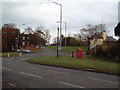
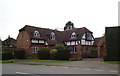
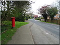
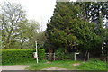
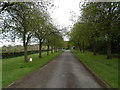
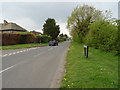
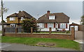
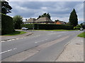
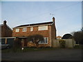

29 photos from this area
Area Information
Key information about the SL9 0LQ including its size, population, and administrative classification.
- Area Type
- Postcode
- Area Size
- 1.0 hectares
- Population
- 1497
- Population Density
- 1880 people/km²
House Prices in SL9 0LQ
19
Properties
£391,975
Average Sold Price
£115,000
Lowest Price
£625,000
Highest Price
Showing 19 properties
| Address | Type | Beds | Baths | Last Sale Price | Last Sale Date | |
|---|---|---|---|---|---|---|
| Knollys, 28 Northdown Road, Chalfont St Peter, SL9 0LQ | Bungalow | 2 | 1 | £550,000 | Feb 2024 | |
| Shangri La, 34 Northdown Road, Chalfont St Peter, SL9 0LQ | Bungalow | 2 | 1 | £590,000 | Aug 2023 | |
| Frabet, 8 Northdown Road, Chalfont St Peter, SL9 0LQ | house | - | - | £625,000 | Nov 2021 | |
| Menton, 30 Northdown Road, Chalfont St Peter, SL9 0LQ | Bungalow | - | - | £480,000 | May 2021 | |
| Casa Rico, 38 Northdown Road, Chalfont St Peter, SL9 0LQ | Bungalow | 3 | 1 | £573,000 | Apr 2020 | |
| La Corbiere, 18 Northdown Road, Chalfont St Peter, SL9 0LQ | house | 3 | - | £530,000 | Aug 2017 | |
| Cottington, 24 Northdown Road, Chalfont St Peter, SL9 0LQ | Bungalow | 3 | - | £457,000 | Nov 2014 | |
| Ponderosa, 36 Northdown Road, Chalfont St Peter, SL9 0LQ | Bungalow | 3 | - | £490,000 | Jun 2014 | |
| 26 Northdown Road, Chalfont St Peter, SL9 0LQ | Detached | 3 | 2 | £435,000 | Aug 2013 | |
| 2 Northdown Road, Chalfont St Peter, SL9 0LQ | Terraced | - | - | £425,000 | Feb 2007 |
Page 1 of 2
Energy Efficiency in SL9 0LQ
Amenities
Schools
| Rank | School | Type | Entry gender | Ages |
|---|
Explore more schools in this area
Go to Schools tabDemographics
Household Size
Two person
most common
Accommodation Type
Houses
most common
Tenure
95
majority
Ethnic Group
White
most common
Religion
N/A
most common
Household Composition
N/A
most common
Age
47
median
Adults (30-64 years)
most common
Household Deprivation
N/A
with no deprivation
NS-SEC
51
in Lower managerial occupations
Explore more demographic insights in this area
Go to Demographics tabPlanning
Planning Constraints
- Flood RiskPremium
- Ramsar Wetland SitesPremium
- Area of Outstanding Natural BeautyPremium
- Protected Nature ReservePremium
- Protected WoodlandPremium