Area Overview for SL9 0EX
Photos of SL9 0EX
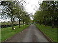
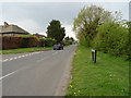
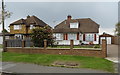
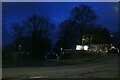
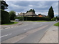
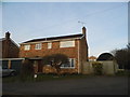
29 photos from this area
Area Information
Key information about the SL9 0EX including its size, population, and administrative classification.
- Area Type
- Postcode
- Area Size
- 4240 m²
- Population
- 1184
- Population Density
- 335 people/km²
House Prices in SL9 0EX
5
Properties
£558,990
Average Sold Price
£295,000
Lowest Price
£900,000
Highest Price
Showing 5 properties
| Address | Type | Beds | Baths | Last Sale Price | Last Sale Date | |
|---|---|---|---|---|---|---|
| White Thorns, 24 Denham Lane, Chalfont St Peter, SL9 0EX | Detached | 3 | 1 | £710,000 | Oct 2017 | |
| Westover, 26 Denham Lane, Chalfont St Peter, SL9 0EX | Detached | 5 | 2 | £900,000 | Mar 2014 | |
| Tyn Coed, 22 Denham Lane, Chalfont St Peter, SL9 0EX | Detached | - | - | £500,000 | Nov 2010 | |
| Wheel House, 20 Denham Lane, Chalfont St Peter, SL9 0EX | Detached | - | - | £389,950 | Jul 2000 | |
| The Mylen, 28 Denham Lane, Chalfont St Peter, SL9 0EX | Detached | - | - | £295,000 | Mar 1998 |
Energy Efficiency in SL9 0EX
Amenities
Schools
| Rank | School | Type | Entry gender | Ages |
|---|
Explore more schools in this area
Go to Schools tabDemographics
Household Size
Family (3-5 people)
most common
Accommodation Type
Houses
most common
Tenure
81
majority
Ethnic Group
White
most common
Religion
N/A
most common
Household Composition
N/A
most common
Age
47
median
Adults (30-64 years)
most common
Household Deprivation
N/A
with no deprivation
NS-SEC
50
in Lower managerial occupations
Explore more demographic insights in this area
Go to Demographics tabPlanning
Planning Constraints
- Flood RiskPremium
- Ramsar Wetland SitesPremium
- Area of Outstanding Natural BeautyPremium
- Protected Nature ReservePremium
- Protected WoodlandPremium