Area Overview for SL8 5RD
Photos of SL8 5RD

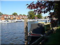
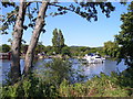
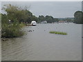
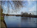
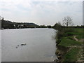
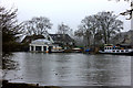
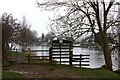
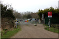
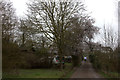
94 photos from this area
Area Information
Key information about the SL8 5RD including its size, population, and administrative classification.
- Area Type
- Postcode
- Area Size
- 2.2 hectares
- Population
- 1462
- Population Density
- 108 people/km²
House Prices in SL8 5RD
15
Properties
£939,886
Average Sold Price
£285,000
Lowest Price
£1,692,500
Highest Price
Showing 15 properties
| Address | Type | Beds | Baths | Last Sale Price | Last Sale Date | |
|---|---|---|---|---|---|---|
| Abbots Inch, The Avenue, Bourne End, SL8 5RD | Detached | 5 | 3 | £1,692,500 | Jun 2025 | |
| Altyre, The Avenue, Bourne End, SL8 5RD | Detached | 4 | 2 | £1,275,000 | Jan 2025 | |
| Heronsgate, The Avenue, Bourne End, SL8 5RD | Detached | 5 | 3 | £1,272,500 | May 2018 | |
| Aspenden, The Avenue, Bourne End, SL8 5RD | house | - | - | £1,150,000 | Jan 2018 | |
| Trees, The Avenue, Bourne End, SL8 5RD | house | - | - | £1,170,000 | Jul 2015 | |
| April Cottage, The Avenue, Bourne End, SL8 5RD | Detached | 5 | 4 | £730,000 | Jan 2010 | |
| Abbots Corner, The Avenue, Bourne End, SL8 5RD | Detached | 4 | - | £696,250 | Aug 2009 | |
| Little Abbots, The Avenue, Bourne End, SL8 5RD | Detached | - | - | £700,000 | Sep 2007 | |
| Holly House, The Avenue, Bourne End, SL8 5RD | Detached | - | - | £972,500 | May 2007 | |
| Brook Cottage, The Avenue, Bourne End, SL8 5RD | Detached | 4 | 2 | £395,000 | Jun 1998 |
Page 1 of 2
Energy Efficiency in SL8 5RD
Amenities
Schools
| Rank | School | Type | Entry gender | Ages |
|---|
Explore more schools in this area
Go to Schools tabDemographics
Household Size
Two person
most common
Accommodation Type
Houses
most common
Tenure
87
majority
Ethnic Group
White
most common
Religion
N/A
most common
Household Composition
N/A
most common
Age
47
median
Adults (30-64 years)
most common
Household Deprivation
N/A
with no deprivation
NS-SEC
52
in Lower managerial occupations
Explore more demographic insights in this area
Go to Demographics tabPlanning
Planning Constraints
- Flood RiskPremium
- Ramsar Wetland SitesPremium
- Area of Outstanding Natural BeautyPremium
- Protected Nature ReservePremium
- Protected WoodlandPremium