Area Overview for SL7 3JD
Photos of SL7 3JD
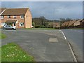
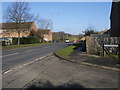
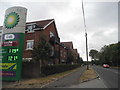

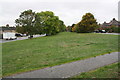
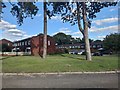
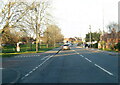
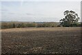
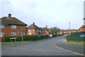
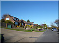
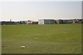
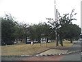
25 photos from this area
Area Information
Key information about the SL7 3JD including its size, population, and administrative classification.
- Area Type
- Postcode
- Area Size
- 1.8 hectares
- Population
- 1478
- Population Density
- 4400 people/km²
House Prices in SL7 3JD
14
Properties
£713,888
Average Sold Price
£260,000
Lowest Price
£1,500,000
Highest Price
Showing 14 properties
| Address | Type | Beds | Baths | Last Sale Price | Last Sale Date | |
|---|---|---|---|---|---|---|
| 116 Wycombe Road, Marlow, SL7 3JD | Detached | 5 | 3 | £1,500,000 | May 2023 | |
| 124 Wycombe Road, Marlow, SL7 3JD | Detached | 4 | 3 | £820,000 | Jun 2022 | |
| 132 Wycombe Road, Marlow, SL7 3JD | Detached | 5 | 3 | £750,000 | Sep 2019 | |
| 126 Wycombe Road, Marlow, SL7 3JD | Semi-detached | 3 | 3 | £605,000 | Jun 2019 | |
| 118 Wycombe Road, Marlow, SL7 3JD | Bungalow | - | - | £800,000 | Jun 2019 | |
| 130 Wycombe Road, Marlow, SL7 3JD | Detached | 5 | 4 | £745,000 | Dec 2013 | |
| 128 Wycombe Road, Marlow, SL7 3JD | house | - | - | £445,000 | Dec 2013 | |
| 122 Wycombe Road, Marlow, SL7 3JD | Detached | 5 | - | £499,995 | Aug 2012 | |
| 120 Wycombe Road, Marlow, SL7 3JD | Detached | 5 | 3 | £260,000 | Aug 1998 | |
| 114D Wycombe Road, Marlow, SL7 3JD | Flat | 5 | 4 | - | - |
Page 1 of 2
Energy Efficiency in SL7 3JD
Amenities
Schools
| Rank | School | Type | Entry gender | Ages |
|---|
Explore more schools in this area
Go to Schools tabDemographics
Household Size
Family (3-5 people)
most common
Accommodation Type
Houses
most common
Tenure
58
majority
Ethnic Group
White
most common
Religion
N/A
most common
Household Composition
N/A
most common
Age
47
median
Adults (30-64 years)
most common
Household Deprivation
N/A
with no deprivation
NS-SEC
39
in Lower managerial occupations
Explore more demographic insights in this area
Go to Demographics tabPlanning
Planning Constraints
- Flood RiskPremium
- Ramsar Wetland SitesPremium
- Area of Outstanding Natural BeautyPremium
- Protected Nature ReservePremium
- Protected WoodlandPremium