Area Overview for SL7 2PN
Photos of SL7 2PN
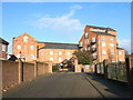
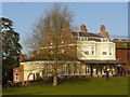
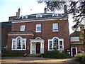
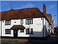
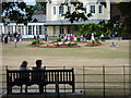
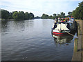
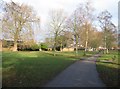
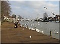


100 photos from this area
Area Information
Key information about the SL7 2PN including its size, population, and administrative classification.
- Area Type
- Postcode
- Area Size
- 1.5 hectares
- Population
- 1534
- Population Density
- 888 people/km²
House Prices in SL7 2PN
12
Properties
£1,054,250
Average Sold Price
£430,000
Lowest Price
£2,500,000
Highest Price
Showing 12 properties
| Address | Type | Beds | Baths | Last Sale Price | Last Sale Date | |
|---|---|---|---|---|---|---|
| Pyghtle House, Chalkpit Lane, Marlow, SL7 2PN | Detached | 5 | 5 | £2,500,000 | Dec 2022 | |
| Juniper House, Chalkpit Lane, Marlow, SL7 2PN | house | - | - | £915,000 | Jul 2021 | |
| Violet House, Chalkpit Lane, Marlow, SL7 2PN | house | - | - | £930,000 | Sep 2020 | |
| Glade House, Chalkpit Lane, Marlow, SL7 2PN | house | - | - | £975,000 | Sep 2020 | |
| Woodynook, Chalkpit Lane, Marlow, SL7 2PN | Semi-detached | 3 | 3 | £925,000 | Mar 2017 | |
| Homestead, Chalkpit Lane, Marlow, SL7 2PN | house | - | - | £910,000 | Jan 2017 | |
| The Larches, Chalkpit Lane, Marlow, SL7 2PN | house | - | - | £849,000 | Aug 2013 | |
| Byeways, Chalkpit Lane, Marlow, SL7 2PN | Semi-detached | 3 | - | £430,000 | Dec 2011 | |
| Waterworks Bungalow, Chalkpit Lane, Marlow, SL7 2PN | Bungalow | 2 | - | - | - | |
| Waterworks Cottage, 2 Chalkpit Lane, Marlow, SL7 2PN | Bungalow | 2 | - | - | - |
Page 1 of 2
Energy Efficiency in SL7 2PN
Amenities
Schools
| Rank | School | Type | Entry gender | Ages |
|---|
Explore more schools in this area
Go to Schools tabDemographics
Household Size
Two person
most common
Accommodation Type
Houses
most common
Tenure
94
majority
Ethnic Group
White
most common
Religion
N/A
most common
Household Composition
N/A
most common
Age
47
median
Adults (30-64 years)
most common
Household Deprivation
N/A
with no deprivation
NS-SEC
61
in Lower managerial occupations
Explore more demographic insights in this area
Go to Demographics tabPlanning
Planning Constraints
- Flood RiskPremium
- Ramsar Wetland SitesPremium
- Area of Outstanding Natural BeautyPremium
- Protected Nature ReservePremium
- Protected WoodlandPremium