Area Overview for SL7 2AE
Photos of SL7 2AE


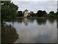


102 photos from this area
Area Information
Key information about the SL7 2AE including its size, population, and administrative classification.
- Area Type
- Postcode
- Area Size
- 1.2 km²
- Population
- 1593
- Population Density
- 947 people/km²
House Prices in SL7 2AE
21
Properties
£1,045,000
Average Sold Price
£585,000
Lowest Price
£1,875,000
Highest Price
Showing 21 properties
| Address | Type | Beds | Baths | Last Sale Price | Last Sale Date | |
|---|---|---|---|---|---|---|
| 5 Pound Lane, Marlow, SL7 2AE | house | 3 | - | £1,875,000 | Jun 2021 | |
| 1 Pound Lane, Marlow, SL7 2AE | Detached | - | - | £675,000 | Oct 2003 | |
| 3 Pound Lane, Marlow, SL7 2AE | Detached | - | - | £585,000 | Jan 2003 | |
| Old Tennis Pavilion, Court Garden Leisure Complex, Pound Lane, Marlow, SL7 2AE | Leisure | - | - | - | - | |
| Costa, Costa Coffee, Higginson Park, Pound Lane, Marlow, SL7 2AE | Restaurant | - | - | - | - | |
| Marlow Sports Ground, Lower Pound Lane, Marlow, SL7 2AE | Leisure | - | - | - | - | |
| Skateboard Park, Higginson Park, Pound Lane, Marlow, SL7 2AE | Leisure | - | - | - | - | |
| Tennis 56M From 8 Pound Lane 32M From Lower Pound Lane, Marlow Boat 28, Marlow, SL7 2AE | Leisure | - | - | - | - | |
| Tennis 37M From Marlow Town Council, Court Garden, Pound Lane 41M From Unnamed Road, Marlow Footpath 24, Marlow, SL7 2AE | Leisure | - | - | - | - | |
| Tennis 109M From Marlow Sports Club, Pound Lane 16M From Lower Pound Lane, Marlow Boat 28, Marlow, SL7 2AE | Leisure | - | - | - | - |
Page 1 of 3
Energy Efficiency in SL7 2AE
Amenities
Schools
| Rank | School | Type | Entry gender | Ages |
|---|
Explore more schools in this area
Go to Schools tabDemographics
Household Size
Family (3-5 people)
most common
Accommodation Type
Houses
most common
Tenure
78
majority
Ethnic Group
White
most common
Religion
N/A
most common
Household Composition
N/A
most common
Age
47
median
Adults (30-64 years)
most common
Household Deprivation
N/A
with no deprivation
NS-SEC
55
in Lower managerial occupations
Explore more demographic insights in this area
Go to Demographics tabPlanning
Planning Constraints
- Flood RiskPremium
- Ramsar Wetland SitesPremium
- Protected Nature ReservePremium
- Protected WoodlandPremium