Area Overview for SL7 1US
Photos of SL7 1US
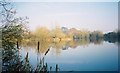
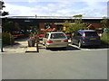
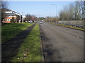

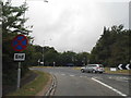
28 photos from this area
Area Information
Key information about the SL7 1US including its size, population, and administrative classification.
- Area Type
- Postcode
- Area Size
- 2737 m²
- Population
- 1235
- Population Density
- 4311 people/km²
House Prices in SL7 1US
11
Properties
£304,886
Average Sold Price
£78,000
Lowest Price
£545,000
Highest Price
Showing 11 properties
| Address | Type | Beds | Baths | Last Sale Price | Last Sale Date | |
|---|---|---|---|---|---|---|
| 7 Kilncroft Close, Marlow, SL7 1US | Terraced | 3 | 1 | £545,000 | Sep 2025 | |
| 1 Kilncroft Close, Marlow, SL7 1US | Terraced | 2 | - | £385,000 | Jun 2021 | |
| 8 Kilncroft Close, Marlow, SL7 1US | Terraced | 3 | 1 | £380,000 | Aug 2020 | |
| 4 Kilncroft Close, Marlow, SL7 1US | house | 2 | 1 | £375,000 | Nov 2019 | |
| 6 Kilncroft Close, Marlow, SL7 1US | Terraced | 2 | 1 | £370,000 | Aug 2019 | |
| 5 Kilncroft Close, Marlow, SL7 1US | Terraced | 2 | - | £375,000 | Aug 2017 | |
| 3 Kilncroft Close, Marlow, SL7 1US | house | - | - | £254,000 | Mar 2016 | |
| 11 Kilncroft Close, Marlow, SL7 1US | house | 2 | 1 | £364,797 | Feb 2016 | |
| 9 Kilncroft Close, Marlow, SL7 1US | Terraced | 2 | - | £110,000 | Jan 1999 | |
| 10 Kilncroft Close, Marlow, SL7 1US | Terraced | - | - | £116,950 | Aug 1998 |
Page 1 of 2
Energy Efficiency in SL7 1US
Amenities
Schools
| Rank | School | Type | Entry gender | Ages |
|---|
Explore more schools in this area
Go to Schools tabDemographics
Household Size
Family (3-5 people)
most common
Accommodation Type
Houses
most common
Tenure
57
majority
Ethnic Group
White
most common
Religion
N/A
most common
Household Composition
N/A
most common
Age
47
median
Adults (30-64 years)
most common
Household Deprivation
N/A
with no deprivation
NS-SEC
35
in Lower managerial occupations
Explore more demographic insights in this area
Go to Demographics tabPlanning
Planning Constraints
- Flood RiskPremium
- Ramsar Wetland SitesPremium
- Area of Outstanding Natural BeautyPremium
- Protected Nature ReservePremium
- Protected WoodlandPremium