Area Overview for SL7 1UQ
Photos of SL7 1UQ
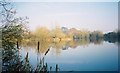
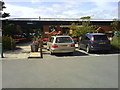
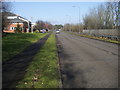
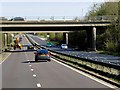
28 photos from this area
Area Information
Key information about the SL7 1UQ including its size, population, and administrative classification.
- Area Type
- Postcode
- Area Size
- 6259 m²
- Population
- 1235
- Population Density
- 4311 people/km²
House Prices in SL7 1UQ
22
Properties
£211,843
Average Sold Price
£83,000
Lowest Price
£346,000
Highest Price
Showing 22 properties
| Address | Type | Beds | Baths | Last Sale Price | Last Sale Date | |
|---|---|---|---|---|---|---|
| 18 Douglas Court, Marlow, SL7 1UQ | Terraced | 3 | 1 | £346,000 | Dec 2020 | |
| 19 Douglas Court, Marlow, SL7 1UQ | house | - | - | £345,000 | Dec 2020 | |
| 11 Douglas Court, Marlow, SL7 1UQ | house | - | - | £324,000 | Mar 2018 | |
| 9 Douglas Court, Marlow, SL7 1UQ | house | - | - | £340,000 | Jun 2016 | |
| 2 Douglas Court, Marlow, SL7 1UQ | Terraced | 3 | 1 | £309,000 | Dec 2015 | |
| 22 Douglas Court, Marlow, SL7 1UQ | house | - | - | £219,000 | Nov 2012 | |
| 20 Douglas Court, Marlow, SL7 1UQ | house | - | - | £212,500 | Oct 2010 | |
| 16 Douglas Court, Marlow, SL7 1UQ | Terraced | 3 | 1 | £199,000 | Jun 2009 | |
| 10 Douglas Court, Marlow, SL7 1UQ | Terraced | 3 | 2 | £208,649 | Feb 2009 | |
| 14 Douglas Court, Marlow, SL7 1UQ | house | - | - | £232,500 | Oct 2007 |
Page 1 of 3
Energy Efficiency in SL7 1UQ
Amenities
Schools
| Rank | School | Type | Entry gender | Ages |
|---|
Explore more schools in this area
Go to Schools tabDemographics
Household Size
Family (3-5 people)
most common
Accommodation Type
Houses
most common
Tenure
57
majority
Ethnic Group
White
most common
Religion
N/A
most common
Household Composition
N/A
most common
Age
47
median
Adults (30-64 years)
most common
Household Deprivation
N/A
with no deprivation
NS-SEC
35
in Lower managerial occupations
Explore more demographic insights in this area
Go to Demographics tabPlanning
Planning Constraints
- Flood RiskPremium
- Ramsar Wetland SitesPremium
- Area of Outstanding Natural BeautyPremium
- Protected Nature ReservePremium
- Protected WoodlandPremium