Area Overview for SL6 9AE
Photos of SL6 9AE


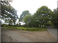
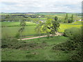
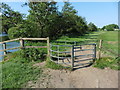
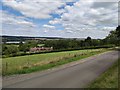


41 photos from this area
Area Information
Key information about the SL6 9AE including its size, population, and administrative classification.
- Area Type
- Postcode
- Area Size
- 14.4 hectares
- Population
- 1896
- Population Density
- 453 people/km²
House Prices in SL6 9AE
19
Properties
£1,705,788
Average Sold Price
£534,000
Lowest Price
£2,750,000
Highest Price
Showing 19 properties
| Address | Type | Beds | Baths | Last Sale Price | Last Sale Date | |
|---|---|---|---|---|---|---|
| Round Copse, Alleyns Lane, Cookham, Maidenhead, SL6 9AE | Detached | - | - | £2,602,300 | May 2023 | |
| Plum Trees, Alleyns Lane, Cookham, Maidenhead, SL6 9AE | house | - | - | £2,750,000 | Dec 2021 | |
| Ashton, Alleyns Lane, Cookham, Maidenhead, SL6 9AE | Detached | 4 | 2 | £1,355,000 | Dec 2021 | |
| Half Timbers, Alleyns Lane, Cookham, Maidenhead, SL6 9AE | house | - | - | £2,200,000 | Dec 2017 | |
| East Cottage, Alleyns Lane, Cookham, Maidenhead, SL6 9AE | house | - | - | £650,000 | Nov 2011 | |
| Duntons Wood, Alleyns Lane, Cookham, Maidenhead, SL6 9AE | Detached | 5 | - | £1,730,000 | Jun 2011 | |
| Asiana, Alleyns Lane, Cookham, Maidenhead, SL6 9AE | Detached | 5 | 5 | £1,825,000 | Apr 2011 | |
| March Cottage, Alleyns Lane, Cookham, Maidenhead, SL6 9AE | Detached | - | - | £534,000 | Jun 2006 | |
| Chanters, Alleyns Lane, Cookham, Maidenhead, SL6 9AE | Detached | 4 | 3 | - | - | |
| Dean Farm, Alleyns Lane, Cookham, Maidenhead, SL6 9AE | Detached | 6 | 4 | - | - |
Page 1 of 2
Energy Efficiency in SL6 9AE
Amenities
Schools
| Rank | School | Type | Entry gender | Ages |
|---|
Explore more schools in this area
Go to Schools tabDemographics
Household Size
Family (3-5 people)
most common
Accommodation Type
Houses
most common
Tenure
85
majority
Ethnic Group
White
most common
Religion
N/A
most common
Household Composition
N/A
most common
Age
47
median
Adults (30-64 years)
most common
Household Deprivation
N/A
with no deprivation
NS-SEC
57
in Lower managerial occupations
Explore more demographic insights in this area
Go to Demographics tabPlanning
Planning Constraints
- Flood RiskPremium
- Ramsar Wetland SitesPremium
- Area of Outstanding Natural BeautyPremium
- Protected Nature ReservePremium
- Protected WoodlandPremium