Area Overview for SL6 8RT
Photos of SL6 8RT


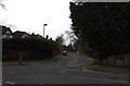
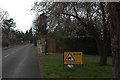
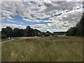
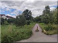
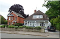

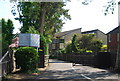

27 photos from this area
Area Information
Key information about the SL6 8RT including its size, population, and administrative classification.
- Area Type
- Postcode
- Area Size
- 3.9 hectares
- Population
- 1634
- Population Density
- 1452 people/km²
House Prices in SL6 8RT
33
Properties
£310,833
Average Sold Price
£107,000
Lowest Price
£635,000
Highest Price
Showing 33 properties
| Address | Type | Beds | Baths | Last Sale Price | Last Sale Date | |
|---|---|---|---|---|---|---|
| 170 Blackamoor Lane, Maidenhead, SL6 8RT | Semi-detached | 3 | 2 | £635,000 | Nov 2023 | |
| 176 Blackamoor Lane, Maidenhead, SL6 8RT | house | 3 | - | £430,000 | May 2021 | |
| 168 Blackamoor Lane, Maidenhead, SL6 8RT | Semi-detached | 3 | 2 | £415,000 | Oct 2019 | |
| 218 Blackamoor Lane, Maidenhead, SL6 8RT | Semi-detached | 2 | - | £385,000 | Jul 2017 | |
| 180 Blackamoor Lane, Maidenhead, SL6 8RT | Semi-detached | 3 | - | £408,000 | Dec 2016 | |
| 186 Blackamoor Lane, Maidenhead, SL6 8RT | house | 3 | - | £402,500 | Feb 2016 | |
| 216 Blackamoor Lane, Maidenhead, SL6 8RT | Semi-detached | 3 | 1 | £295,000 | Oct 2013 | |
| 182 Blackamoor Lane, Maidenhead, SL6 8RT | Semi-detached | 3 | 2 | £307,500 | Aug 2013 | |
| 164 Blackamoor Lane, Maidenhead, SL6 8RT | Semi-detached | 3 | 2 | £250,000 | Aug 2013 | |
| 178 Blackamoor Lane, Maidenhead, SL6 8RT | Semi-detached | 3 | 1 | £185,000 | Jun 2009 |
Page 1 of 4
Energy Efficiency in SL6 8RT
Amenities
Schools
| Rank | School | Type | Entry gender | Ages |
|---|
Explore more schools in this area
Go to Schools tabDemographics
Household Size
Family (3-5 people)
most common
Accommodation Type
Houses
most common
Tenure
70
majority
Ethnic Group
White
most common
Religion
N/A
most common
Household Composition
N/A
most common
Age
47
median
Adults (30-64 years)
most common
Household Deprivation
N/A
with no deprivation
NS-SEC
33
in Lower managerial occupations
Explore more demographic insights in this area
Go to Demographics tabPlanning
Planning Constraints
- Flood RiskPremium
- Ramsar Wetland SitesPremium
- Area of Outstanding Natural BeautyPremium
- Protected Nature ReservePremium
- Protected WoodlandPremium