Area Overview for SL6 8EL
Photos of SL6 8EL
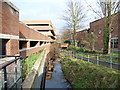

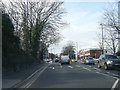
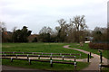
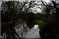
100 photos from this area
Area Information
Key information about the SL6 8EL including its size, population, and administrative classification.
- Area Type
- Postcode
- Area Size
- 1.1 hectares
- Population
- 1903
- Population Density
- 3205 people/km²
House Prices in SL6 8EL
52
Properties
£419,125
Average Sold Price
£375,000
Lowest Price
£569,000
Highest Price
Showing 52 properties
| Address | Type | Beds | Baths | Last Sale Price | Last Sale Date | |
|---|---|---|---|---|---|---|
| 8 Kingfisher Drive, Maidenhead, SL6 8EL | house | - | - | £569,000 | Jan 2025 | |
| 17 Kingfisher Drive, Maidenhead, SL6 8EL | Terraced | 3 | 2 | £456,000 | Mar 2020 | |
| 25 Kingfisher Drive, Maidenhead, SL6 8EL | Terraced | 3 | 2 | £388,000 | Dec 2013 | |
| 15 Kingfisher Drive, Maidenhead, SL6 8EL | house | - | - | £390,000 | Nov 2013 | |
| 29 Kingfisher Drive, Maidenhead, SL6 8EL | Terraced | 3 | 2 | £400,000 | Nov 2013 | |
| 21 Kingfisher Drive, Maidenhead, SL6 8EL | Terraced | 3 | 2 | £400,000 | Oct 2013 | |
| 7 Kingfisher Drive, Maidenhead, SL6 8EL | Terraced | 3 | 2 | £375,000 | Feb 2013 | |
| 9 Kingfisher Drive, Maidenhead, SL6 8EL | house | - | - | £375,000 | Dec 2012 | |
| Flat 3, Partridge Place, 1 Kingfisher Drive, Maidenhead, SL6 8EL | Flat | 2 | 2 | - | - | |
| Flat 3, Moorland Place, 31 Kingfisher Drive, Maidenhead, SL6 8EL | Flat | 2 | 2 | - | - |
Page 1 of 6
Energy Efficiency in SL6 8EL
Amenities
Schools
| Rank | School | Type | Entry gender | Ages |
|---|
Explore more schools in this area
Go to Schools tabDemographics
Household Size
Family (3-5 people)
most common
Accommodation Type
Houses
most common
Tenure
75
majority
Ethnic Group
White
most common
Religion
N/A
most common
Household Composition
N/A
most common
Age
47
median
Adults (30-64 years)
most common
Household Deprivation
N/A
with no deprivation
NS-SEC
54
in Lower managerial occupations
Explore more demographic insights in this area
Go to Demographics tabPlanning
Planning Constraints
- Flood RiskPremium
- Ramsar Wetland SitesPremium
- Area of Outstanding Natural BeautyPremium
- Protected Nature ReservePremium
- Protected WoodlandPremium