Area Overview for SL6 8DS
Photos of SL6 8DS
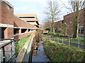

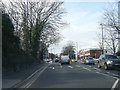
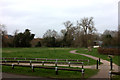
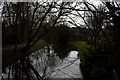
100 photos from this area
Area Information
Key information about the SL6 8DS including its size, population, and administrative classification.
- Area Type
- Postcode
- Area Size
- 1.2 hectares
- Population
- 1694
- Population Density
- 3896 people/km²
House Prices in SL6 8DS
19
Properties
£1,187,800
Average Sold Price
£600,000
Lowest Price
£1,675,000
Highest Price
Showing 19 properties
| Address | Type | Beds | Baths | Last Sale Price | Last Sale Date | |
|---|---|---|---|---|---|---|
| Linden, 8 Ray Park Avenue, Maidenhead, SL6 8DS | Detached | 5 | 3 | £1,520,000 | Aug 2022 | |
| Park House, 10 Ray Park Avenue, Maidenhead, SL6 8DS | Detached | 6 | 3 | £1,675,000 | Aug 2022 | |
| 12 Ray Park Avenue, Maidenhead, SL6 8DS | house | - | - | £1,406,500 | Jul 2021 | |
| 16 Ray Park Avenue, Maidenhead, SL6 8DS | Detached | - | - | £600,000 | Nov 2008 | |
| 18 Ray Park Avenue, Maidenhead, SL6 8DS | Detached | - | - | £737,500 | Dec 2005 | |
| 14A Ray Park Avenue, Maidenhead, SL6 8DS | Detached | 3 | 1 | - | - | |
| Flat 2, Thamebridge Court, 20 Ray Park Avenue, Maidenhead, SL6 8DS | Flat | 1 | 1 | - | - | |
| Rayham, 4 Ray Park Avenue, Maidenhead, SL6 8DS | Semi-detached | 3 | 1 | - | - | |
| Annexe, St Margarets, 2 Ray Park Avenue, Maidenhead, SL6 8DS | Flat | - | - | - | - | |
| St Margarets, 2 Ray Park Avenue, Maidenhead, SL6 8DS | Semi-detached | - | - | - | - |
Page 1 of 2
Energy Efficiency in SL6 8DS
Amenities
Schools
| Rank | School | Type | Entry gender | Ages |
|---|
Explore more schools in this area
Go to Schools tabDemographics
Household Size
One person
most common
Accommodation Type
Houses
most common
Tenure
63
majority
Ethnic Group
White
most common
Religion
N/A
most common
Household Composition
N/A
most common
Age
47
median
Adults (30-64 years)
most common
Household Deprivation
N/A
with no deprivation
NS-SEC
50
in Lower managerial occupations
Explore more demographic insights in this area
Go to Demographics tabPlanning
Planning Constraints
- Flood RiskPremium
- Ramsar Wetland SitesPremium
- Area of Outstanding Natural BeautyPremium
- Protected Nature ReservePremium
- Protected WoodlandPremium