Area Overview for SL6 2ED
Photos of SL6 2ED

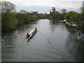

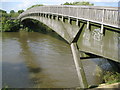

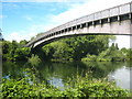
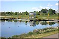
60 photos from this area
Area Information
Key information about the SL6 2ED including its size, population, and administrative classification.
- Area Type
- Postcode
- Area Size
- 36.2 hectares
- Population
- 1616
- Population Density
- 235 people/km²
House Prices in SL6 2ED
15
Properties
£1,175,833
Average Sold Price
£680,000
Lowest Price
£2,065,000
Highest Price
Showing 15 properties
| Address | Type | Beds | Baths | Last Sale Price | Last Sale Date | |
|---|---|---|---|---|---|---|
| Brayfield House, Monkey Island Lane, Bray, Maidenhead, SL6 2ED | house | - | - | £680,000 | Aug 2018 | |
| Brook House, Monkey Island Lane, Bray, Maidenhead, SL6 2ED | house | 4 | - | £2,065,000 | Dec 2017 | |
| River Place, Monkey Island Lane, Bray, Maidenhead, SL6 2ED | Bungalow | 4 | - | £1,400,000 | Aug 2017 | |
| Sundial Cottage, Monkey Island Lane, Bray, Maidenhead, SL6 2ED | Bungalow | - | - | £1,300,000 | Nov 2016 | |
| Mulberry House, Monkey Island Lane, Bray, Maidenhead, SL6 2ED | house | 4 | - | £910,000 | Sep 2006 | |
| Weir Bank Lodge, Monkey Island Lane, Bray, Maidenhead, SL6 2ED | office_workshop | - | - | £700,000 | Apr 2006 | |
| Long White Cloud, Monkey Island Lane, Bray, Maidenhead, SL6 2ED | house | 5 | - | - | - | |
| The Old Music Room, Monkey Island Lane, Bray, Maidenhead, SL6 2ED | house | 5 | - | - | - | |
| Water Works, Monkey Island Lane, Bray, Maidenhead, SL6 2ED | Industrial | - | - | - | - | |
| The Edwardian Marquee, Weir Bank, Monkey Island Lane, Bray, Maidenhead, SL6 2ED | Leisure | - | - | - | - |
Page 1 of 2
Energy Efficiency in SL6 2ED
Amenities
Schools
| Rank | School | Type | Entry gender | Ages |
|---|
Explore more schools in this area
Go to Schools tabDemographics
Household Size
Family (3-5 people)
most common
Accommodation Type
Houses
most common
Tenure
83
majority
Ethnic Group
White
most common
Religion
N/A
most common
Household Composition
N/A
most common
Age
47
median
Adults (30-64 years)
most common
Household Deprivation
N/A
with no deprivation
NS-SEC
48
in Lower managerial occupations
Explore more demographic insights in this area
Go to Demographics tabPlanning
Planning Constraints
- Flood RiskPremium
- Ramsar Wetland SitesPremium
- Area of Outstanding Natural BeautyPremium
- Protected Nature ReservePremium
- Protected WoodlandPremium