Area Overview for SL6 2DW
Photos of SL6 2DW


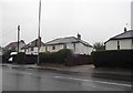
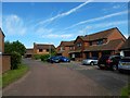
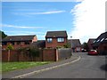

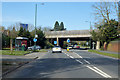
29 photos from this area
Area Information
Key information about the SL6 2DW including its size, population, and administrative classification.
- Area Type
- Postcode
- Area Size
- 13.5 hectares
- Population
- 1616
- Population Density
- 235 people/km²
House Prices in SL6 2DW
59
Properties
£454,541
Average Sold Price
£90,000
Lowest Price
£860,000
Highest Price
Showing 59 properties
| Address | Type | Beds | Baths | Last Sale Price | Last Sale Date | |
|---|---|---|---|---|---|---|
| 114 Windsor Road, Maidenhead, SL6 2DW | Semi-detached | 3 | 2 | £725,000 | Sep 2024 | |
| 120 Windsor Road, Maidenhead, SL6 2DW | Detached | 4 | 2 | £860,000 | Jun 2024 | |
| 116 Windsor Road, Maidenhead, SL6 2DW | Semi-detached | 3 | 2 | £685,000 | Sep 2023 | |
| 118 Windsor Road, Maidenhead, SL6 2DW | Detached | 4 | 2 | £820,000 | Jan 2023 | |
| 164 Windsor Road, Maidenhead, SL6 2DW | house | 4 | 2 | £700,000 | Oct 2022 | |
| 218 Windsor Road, Maidenhead, SL6 2DW | house | 3 | 1 | £580,000 | Sep 2022 | |
| 166 Windsor Road, Maidenhead, SL6 2DW | Retail | 3 | 1 | £565,000 | Aug 2022 | |
| 170 Windsor Road, Maidenhead, SL6 2DW | house | - | - | £500,000 | Mar 2021 | |
| 212 Windsor Road, Maidenhead, SL6 2DW | house | 3 | - | £420,000 | Feb 2021 | |
| 216 Windsor Road, Maidenhead, SL6 2DW | Terraced | 3 | 1 | £465,000 | Aug 2020 |
Page 1 of 6
Energy Efficiency in SL6 2DW
Amenities
Schools
| Rank | School | Type | Entry gender | Ages |
|---|
Explore more schools in this area
Go to Schools tabDemographics
Household Size
Family (3-5 people)
most common
Accommodation Type
Houses
most common
Tenure
83
majority
Ethnic Group
White
most common
Religion
N/A
most common
Household Composition
N/A
most common
Age
47
median
Adults (30-64 years)
most common
Household Deprivation
N/A
with no deprivation
NS-SEC
48
in Lower managerial occupations
Explore more demographic insights in this area
Go to Demographics tabPlanning
Planning Constraints
- Flood RiskPremium
- Ramsar Wetland SitesPremium
- Area of Outstanding Natural BeautyPremium
- Protected Nature ReservePremium
- Protected WoodlandPremium