Area Overview for SL5 0JA
Photos of SL5 0JA
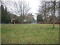
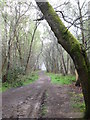
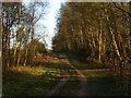
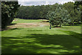
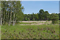
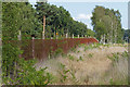


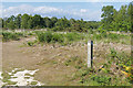
33 photos from this area
Area Information
Key information about the SL5 0JA including its size, population, and administrative classification.
- Area Type
- Postcode
- Area Size
- 13.6 hectares
- Population
- 1235
- Population Density
- 77 people/km²
House Prices in SL5 0JA
15
Properties
£664,556
Average Sold Price
£305,000
Lowest Price
£1,450,000
Highest Price
Showing 15 properties
| Address | Type | Beds | Baths | Last Sale Price | Last Sale Date | |
|---|---|---|---|---|---|---|
| 186 Chobham Road, Sunningdale, Ascot, SL5 0JA | Terraced | 3 | - | £480,000 | Jun 2017 | |
| 192 Chobham Road, Sunningdale, Ascot, SL5 0JA | Terraced | 3 | - | £478,000 | Jun 2014 | |
| Chobham Lodge, 170 Chobham Road, Sunningdale, Ascot, SL5 0JA | house | 5 | 3 | £1,450,000 | Dec 2012 | |
| Kingswood Lodge, 174 Chobham Road, Sunningdale, Ascot, SL5 0JA | Detached | 4 | - | £540,000 | Jan 2006 | |
| 194 Chobham Road, Sunningdale, Ascot, SL5 0JA | Terraced | 3 | - | £305,000 | Sep 2004 | |
| 180 Chobham Road, Sunningdale, Ascot, SL5 0JA | Detached | - | - | £1,023,000 | Jul 2003 | |
| 178 Chobham Road, Sunningdale, Ascot, SL5 0JA | house | 5 | - | £950,000 | Jun 2003 | |
| 196A Chobham Road, Sunningdale, Ascot, SL5 0JA | Land | - | - | £330,000 | Apr 2003 | |
| The Clock House, 172 Chobham Road, Sunningdale, Ascot, SL5 0JA | house | - | - | £425,000 | May 1999 | |
| 196 Chobham Road, Sunningdale, Ascot, SL5 0JA | Terraced | 2 | - | - | - |
Page 1 of 2
Energy Efficiency in SL5 0JA
Amenities
Schools
| Rank | School | Type | Entry gender | Ages |
|---|
Explore more schools in this area
Go to Schools tabDemographics
Household Size
Two person
most common
Accommodation Type
Houses
most common
Tenure
81
majority
Ethnic Group
White
most common
Religion
N/A
most common
Household Composition
N/A
most common
Age
47
median
Adults (30-64 years)
most common
Household Deprivation
N/A
with no deprivation
NS-SEC
47
in Lower managerial occupations
Explore more demographic insights in this area
Go to Demographics tabPlanning
Planning Constraints
- Flood RiskPremium
- Ramsar Wetland SitesPremium
- Area of Outstanding Natural BeautyPremium
- Protected Nature ReservePremium
- Protected WoodlandPremium