Area Overview for SL4 5PQ
Photos of SL4 5PQ
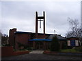
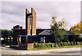
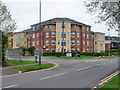
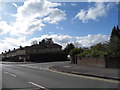
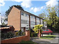
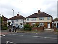
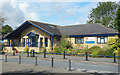
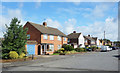
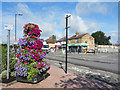
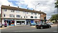
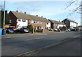
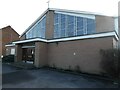
20 photos from this area
Area Information
Key information about the SL4 5PQ including its size, population, and administrative classification.
- Area Type
- Postcode
- Area Size
- 1.8 hectares
- Population
- 1775
- Population Density
- 5085 people/km²
House Prices in SL4 5PQ
30
Properties
£337,850
Average Sold Price
£210,000
Lowest Price
£565,000
Highest Price
Showing 30 properties
| Address | Type | Beds | Baths | Last Sale Price | Last Sale Date | |
|---|---|---|---|---|---|---|
| 27 St Georges Close, Windsor, SL4 5PQ | Semi-detached | 3 | 1 | £565,000 | Jun 2025 | |
| 14 St Georges Close, Windsor, SL4 5PQ | Semi-detached | 3 | 1 | £470,000 | Mar 2024 | |
| 25 St Georges Close, Windsor, SL4 5PQ | house | - | - | £490,000 | Dec 2021 | |
| 23 St Georges Close, Windsor, SL4 5PQ | Semi-detached | 2 | 2 | £385,000 | Dec 2019 | |
| 21 St Georges Close, Windsor, SL4 5PQ | house | 3 | - | £399,950 | Nov 2016 | |
| 11 St Georges Close, Windsor, SL4 5PQ | Detached | 2 | 1 | £455,000 | Aug 2016 | |
| 22 St Georges Close, Windsor, SL4 5PQ | Detached | 5 | 3 | £250,000 | Apr 2009 | |
| 18 St Georges Close, Windsor, SL4 5PQ | Semi-detached | - | - | £250,000 | Jan 2009 | |
| 3 St Georges Close, Windsor, SL4 5PQ | Terraced | - | - | £305,000 | Jun 2007 | |
| 29 St Georges Close, Windsor, SL4 5PQ | Semi-detached | 4 | 2 | £230,000 | Jan 2006 |
Page 1 of 3
Energy Efficiency in SL4 5PQ
Amenities
Schools
| Rank | School | Type | Entry gender | Ages |
|---|
Explore more schools in this area
Go to Schools tabDemographics
Household Size
Family (3-5 people)
most common
Accommodation Type
Houses
most common
Tenure
46
majority
Ethnic Group
White
most common
Religion
N/A
most common
Household Composition
N/A
most common
Age
47
median
Adults (30-64 years)
most common
Household Deprivation
N/A
with no deprivation
NS-SEC
31
in Lower managerial occupations
Explore more demographic insights in this area
Go to Demographics tabPlanning
Planning Constraints
- Flood RiskPremium
- Ramsar Wetland SitesPremium
- Area of Outstanding Natural BeautyPremium
- Protected Nature ReservePremium
- Protected WoodlandPremium