Area Overview for SL3 9PN
Photos of SL3 9PN

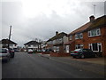
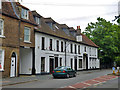
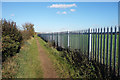
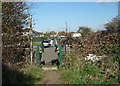
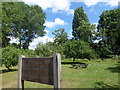
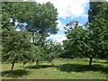
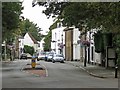
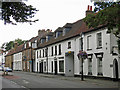
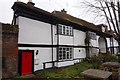
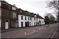

21 photos from this area
Area Information
Key information about the SL3 9PN including its size, population, and administrative classification.
- Area Type
- Postcode
- Area Size
- 7.7 hectares
- Population
- 1865
- Population Density
- 360 people/km²
House Prices in SL3 9PN
11
Properties
£300,386
Average Sold Price
£88,500
Lowest Price
£527,500
Highest Price
Showing 11 properties
| Address | Type | Beds | Baths | Last Sale Price | Last Sale Date | |
|---|---|---|---|---|---|---|
| Colne View, Mill Lane, Horton, Slough, SL3 9PN | Bungalow | 4 | 2 | £515,000 | Apr 2023 | |
| Iona, Mill Lane, Horton, Slough, SL3 9PN | Detached | 4 | 2 | £527,500 | Jun 2016 | |
| Clifden, Mill Lane, Horton, Slough, SL3 9PN | Detached | 5 | 3 | £335,000 | Aug 2007 | |
| Coppertops, Mill Lane, Horton, Slough, SL3 9PN | Detached | 4 | 2 | £335,000 | Nov 2006 | |
| Tigeen, Mill Lane, Horton, Slough, SL3 9PN | house | - | - | £129,950 | Mar 1997 | |
| New Mill Cottage, Mill Lane, Horton, Slough, SL3 9PN | Detached | 4 | 2 | £171,750 | Jul 1996 | |
| Old Mill Cottage, Mill Lane, Horton, Slough, SL3 9PN | Semi-detached | - | - | £88,500 | Mar 1996 | |
| Pine Lodge, Mill Lane, Horton, Slough, SL3 9PN | Bungalow | 3 | 1 | - | - | |
| Day And Knight Bedroom Design, Day And Knight Bedroom Design And Fitting, New Mill Cottage, Mill Lane, Horton, Slough, SL3 9PN | Office | - | - | - | - | |
| The Haven, Mill Lane, Horton, Slough, SL3 9PN | Bungalow | - | - | - | - |
Page 1 of 2
Energy Efficiency in SL3 9PN
Amenities
Schools
| Rank | School | Type | Entry gender | Ages |
|---|
Explore more schools in this area
Go to Schools tabDemographics
Household Size
Family (3-5 people)
most common
Accommodation Type
Houses
most common
Tenure
66
majority
Ethnic Group
White
most common
Religion
N/A
most common
Household Composition
N/A
most common
Age
47
median
Adults (30-64 years)
most common
Household Deprivation
N/A
with no deprivation
NS-SEC
37
in Lower managerial occupations
Explore more demographic insights in this area
Go to Demographics tabPlanning
Planning Constraints
- Flood RiskPremium
- Ramsar Wetland SitesPremium
- Area of Outstanding Natural BeautyPremium
- Protected Nature ReservePremium
- Protected WoodlandPremium