Area Overview for SL3 9HJ
Photos of SL3 9HJ
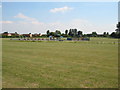
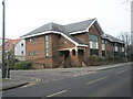
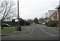
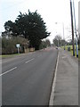
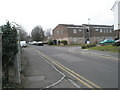
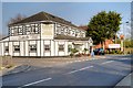

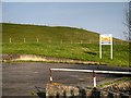
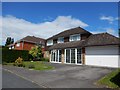
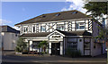

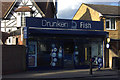
37 photos from this area
Area Information
Key information about the SL3 9HJ including its size, population, and administrative classification.
- Area Type
- Postcode
- Area Size
- 3336 m²
- Population
- 1699
- Population Density
- 886 people/km²
House Prices in SL3 9HJ
14
Properties
£173,995
Average Sold Price
£57,000
Lowest Price
£343,000
Highest Price
Showing 14 properties
| Address | Type | Beds | Baths | Last Sale Price | Last Sale Date | |
|---|---|---|---|---|---|---|
| 170 Horton Road, Datchet, Slough, SL3 9HJ | Flat | 1 | 1 | £180,000 | Mar 2025 | |
| 164 Horton Road, Datchet, Slough, SL3 9HJ | Flat | 1 | 1 | £187,500 | May 2022 | |
| 140 Horton Road, Datchet, Slough, SL3 9HJ | Semi-detached | 3 | 1 | £343,000 | May 2016 | |
| 166 Horton Road, Datchet, Slough, SL3 9HJ | Flat | - | - | £163,000 | Apr 2015 | |
| 168 Horton Road, Datchet, Slough, SL3 9HJ | Flat | 1 | 1 | £163,500 | Feb 2014 | |
| 176 Horton Road, Datchet, Slough, SL3 9HJ | Flat | - | - | £135,000 | Aug 2013 | |
| 172 Horton Road, Datchet, Slough, SL3 9HJ | Bungalow | 2 | - | £220,000 | Apr 2011 | |
| 178 Horton Road, Datchet, Slough, SL3 9HJ | Flat | - | - | £176,000 | Dec 2007 | |
| 174 Horton Road, Datchet, Slough, SL3 9HJ | Flat | - | - | £114,950 | Sep 2002 | |
| 180 Horton Road, Datchet, Slough, SL3 9HJ | Flat | 1 | 1 | £57,000 | Aug 1997 |
Page 1 of 2
Energy Efficiency in SL3 9HJ
Amenities
Schools
| Rank | School | Type | Entry gender | Ages |
|---|
Explore more schools in this area
Go to Schools tabDemographics
Household Size
One person
most common
Accommodation Type
Houses
most common
Tenure
54
majority
Ethnic Group
White
most common
Religion
N/A
most common
Household Composition
N/A
most common
Age
47
median
Adults (30-64 years)
most common
Household Deprivation
N/A
with no deprivation
NS-SEC
36
in Lower managerial occupations
Explore more demographic insights in this area
Go to Demographics tabPlanning
Planning Constraints
- Flood RiskPremium
- Ramsar Wetland SitesPremium
- Area of Outstanding Natural BeautyPremium
- Protected Nature ReservePremium
- Protected WoodlandPremium