Area Overview for SL3 9AB
Photos of SL3 9AB
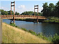
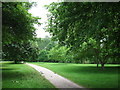
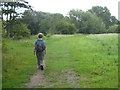


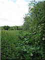
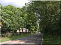
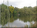
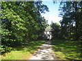
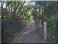

65 photos from this area
Area Information
Key information about the SL3 9AB including its size, population, and administrative classification.
- Area Type
- Postcode
- Area Size
- 2.5 hectares
- Population
- 2045
- Population Density
- 3136 people/km²
House Prices in SL3 9AB
47
Properties
£331,773
Average Sold Price
£54,500
Lowest Price
£595,000
Highest Price
Showing 47 properties
| Address | Type | Beds | Baths | Last Sale Price | Last Sale Date | |
|---|---|---|---|---|---|---|
| 9 The Myrke, Slough, SL3 9AB | house | - | - | £485,000 | Aug 2025 | |
| 37 The Myrke, Slough, SL3 9AB | Terraced | 2 | 1 | £377,500 | May 2025 | |
| 53 The Myrke, Slough, SL3 9AB | house | - | - | £500,000 | Sep 2024 | |
| 63 The Myrke, Slough, SL3 9AB | Semi-detached | 3 | 2 | £432,000 | Mar 2024 | |
| 33 The Myrke, Slough, SL3 9AB | Semi-detached | 3 | 2 | £538,000 | May 2023 | |
| 75 The Myrke, Slough, SL3 9AB | Retail | 3 | 1 | £418,000 | Sep 2022 | |
| 45 The Myrke, Slough, SL3 9AB | Detached | 5 | 2 | £595,000 | Jun 2022 | |
| 21 The Myrke, Slough, SL3 9AB | Detached | - | - | £370,000 | Apr 2022 | |
| 13 The Myrke, Slough, SL3 9AB | Detached | 5 | 3 | £345,000 | Apr 2021 | |
| 51 The Myrke, Slough, SL3 9AB | Semi-detached | 3 | 1 | £390,000 | Feb 2021 |
Page 1 of 5
Energy Efficiency in SL3 9AB
Amenities
Schools
| Rank | School | Type | Entry gender | Ages |
|---|
Explore more schools in this area
Go to Schools tabDemographics
Household Size
One person
most common
Accommodation Type
Flats
most common
Tenure
42
majority
Ethnic Group
White
most common
Religion
N/A
most common
Household Composition
N/A
most common
Age
47
median
Adults (30-64 years)
most common
Household Deprivation
N/A
with no deprivation
NS-SEC
38
in Lower managerial occupations
Explore more demographic insights in this area
Go to Demographics tabPlanning
Planning Constraints
- Flood RiskPremium
- Ramsar Wetland SitesPremium
- Area of Outstanding Natural BeautyPremium
- Protected Nature ReservePremium
- Protected WoodlandPremium