Area Overview for SL3 8WE
Photos of SL3 8WE
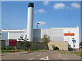
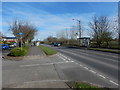
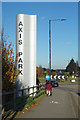
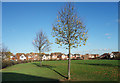

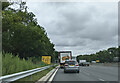
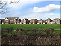
20 photos from this area
Area Information
Key information about the SL3 8WE including its size, population, and administrative classification.
- Area Type
- Postcode
- Area Size
- 3.1 hectares
- Population
- 1804
- Population Density
- 5211 people/km²
House Prices in SL3 8WE
28
Properties
£304,193
Average Sold Price
£175,000
Lowest Price
£600,000
Highest Price
Showing 28 properties
| Address | Type | Beds | Baths | Last Sale Price | Last Sale Date | |
|---|---|---|---|---|---|---|
| 23 Grasholm Way, Slough, SL3 8WE | Retail | 4 | 4 | £600,000 | Sep 2022 | |
| 47 Grasholm Way, Slough, SL3 8WE | Retail | 4 | 3 | £527,000 | Aug 2022 | |
| 2 Grasholm Way, Slough, SL3 8WE | Detached | 4 | 3 | £500,000 | Apr 2017 | |
| 4 Grasholm Way, Slough, SL3 8WE | house | 3 | - | £340,000 | May 2015 | |
| 9 Grasholm Way, Slough, SL3 8WE | Detached | 4 | - | £470,000 | Feb 2015 | |
| 37 Grasholm Way, Slough, SL3 8WE | Flat | 3 | 2 | £270,000 | Oct 2014 | |
| 19 Grasholm Way, Slough, SL3 8WE | Terraced | 5 | 4 | £328,000 | Jul 2013 | |
| 11 Grasholm Way, Slough, SL3 8WE | Terraced | 4 | - | £340,000 | Oct 2011 | |
| 33 Grasholm Way, Slough, SL3 8WE | Flat | 3 | 2 | £245,000 | Nov 2010 | |
| 21 Grasholm Way, Slough, SL3 8WE | Terraced | 4 | 2 | £345,000 | Nov 2010 |
Page 1 of 3
Energy Efficiency in SL3 8WE
Amenities
Schools
| Rank | School | Type | Entry gender | Ages |
|---|
Explore more schools in this area
Go to Schools tabDemographics
Household Size
Family (3-5 people)
most common
Accommodation Type
Houses
most common
Tenure
63
majority
Ethnic Group
asian_total
most common
Religion
N/A
most common
Household Composition
N/A
most common
Age
47
median
Adults (30-64 years)
most common
Household Deprivation
N/A
with no deprivation
NS-SEC
32
in Lower managerial occupations
Explore more demographic insights in this area
Go to Demographics tabPlanning
Planning Constraints
- Flood RiskPremium
- Ramsar Wetland SitesPremium
- Area of Outstanding Natural BeautyPremium
- Protected Nature ReservePremium
- Protected WoodlandPremium