Area Overview for SL3 8QS
Photos of SL3 8QS

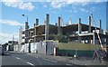
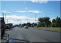
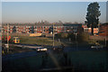
40 photos from this area
Area Information
Key information about the SL3 8QS including its size, population, and administrative classification.
- Area Type
- Postcode
- Area Size
- 4614 m²
- Population
- 1478
- Population Density
- 4555 people/km²
House Prices in SL3 8QS
18
Properties
£223,216
Average Sold Price
£134,950
Lowest Price
£420,000
Highest Price
Showing 18 properties
| Address | Type | Beds | Baths | Last Sale Price | Last Sale Date | |
|---|---|---|---|---|---|---|
| 1 Laburnum Grove, Slough, SL3 8QS | Maisonette | 2 | 1 | £250,000 | Jun 2023 | |
| 17 Laburnum Grove, Slough, SL3 8QS | Terraced | 3 | 1 | £420,000 | Mar 2023 | |
| 6 Laburnum Grove, Slough, SL3 8QS | Maisonette | 2 | 1 | £266,000 | Feb 2022 | |
| 3 Laburnum Grove, Slough, SL3 8QS | Maisonette | 2 | 1 | £253,500 | Sep 2021 | |
| 9 Laburnum Grove, Slough, SL3 8QS | Maisonette | 2 | - | £275,000 | Feb 2021 | |
| 5 Laburnum Grove, Slough, SL3 8QS | Maisonette | 2 | 1 | £257,000 | Aug 2016 | |
| 10 Laburnum Grove, Slough, SL3 8QS | Maisonette | 2 | 1 | £245,000 | Apr 2016 | |
| 14 Laburnum Grove, Slough, SL3 8QS | Maisonette | - | - | £205,000 | Nov 2014 | |
| 11 Laburnum Grove, Slough, SL3 8QS | Maisonette | 2 | - | £195,000 | Sep 2014 | |
| 16 Laburnum Grove, Slough, SL3 8QS | house | - | - | £185,000 | Aug 2009 |
Page 1 of 2
Energy Efficiency in SL3 8QS
Amenities
Schools
| Rank | School | Type | Entry gender | Ages |
|---|
Explore more schools in this area
Go to Schools tabDemographics
Household Size
Family (3-5 people)
most common
Accommodation Type
Houses
most common
Tenure
46
majority
Ethnic Group
White
most common
Religion
N/A
most common
Household Composition
N/A
most common
Age
47
median
Adults (30-64 years)
most common
Household Deprivation
N/A
with no deprivation
NS-SEC
26
in Lower managerial occupations
Explore more demographic insights in this area
Go to Demographics tabPlanning
Planning Constraints
- Flood RiskPremium
- Ramsar Wetland SitesPremium
- Area of Outstanding Natural BeautyPremium
- Protected Nature ReservePremium
- Protected WoodlandPremium