Area Overview for SL2 5PR
Photos of SL2 5PR


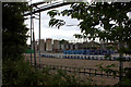

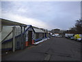

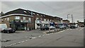
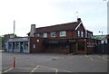
39 photos from this area
Area Information
Key information about the SL2 5PR including its size, population, and administrative classification.
- Area Type
- Postcode
- Area Size
- 4594 m²
- Population
- 1963
- Population Density
- 12535 people/km²
House Prices in SL2 5PR
16
Properties
£217,350
Average Sold Price
£91,500
Lowest Price
£375,000
Highest Price
Showing 16 properties
| Address | Type | Beds | Baths | Last Sale Price | Last Sale Date | |
|---|---|---|---|---|---|---|
| 66 Broadmark Road, Slough, SL2 5PR | Terraced | 3 | 2 | £375,000 | Mar 2024 | |
| 68 Broadmark Road, Slough, SL2 5PR | Terraced | 3 | 1 | £348,000 | Apr 2020 | |
| 60 Broadmark Road, Slough, SL2 5PR | house | - | - | £279,950 | Jul 2015 | |
| 70 Broadmark Road, Slough, SL2 5PR | Terraced | - | - | £180,000 | Jul 2007 | |
| 76 Broadmark Road, Slough, SL2 5PR | house | - | - | £155,000 | Jul 2003 | |
| 82 Broadmark Road, Slough, SL2 5PR | house | - | - | £91,500 | Aug 2000 | |
| 80 Broadmark Road, Slough, SL2 5PR | Semi-detached | - | - | £92,000 | Jun 2000 | |
| 78 Broadmark Road, Slough, SL2 5PR | Terraced | - | - | - | - | |
| 58 Broadmark Road, Slough, SL2 5PR | Terraced | - | - | - | - | |
| 62 Broadmark Road, Slough, SL2 5PR | house | - | - | - | - |
Page 1 of 2
Energy Efficiency in SL2 5PR
Amenities
Schools
| Rank | School | Type | Entry gender | Ages |
|---|
Explore more schools in this area
Go to Schools tabDemographics
Household Size
Family (3-5 people)
most common
Accommodation Type
Houses
most common
Tenure
56
majority
Ethnic Group
asian_total
most common
Religion
N/A
most common
Household Composition
N/A
most common
Age
47
median
Adults (30-64 years)
most common
Household Deprivation
N/A
with no deprivation
NS-SEC
19
in Lower managerial occupations
Explore more demographic insights in this area
Go to Demographics tabPlanning
Planning Constraints
- Flood RiskPremium
- Ramsar Wetland SitesPremium
- Area of Outstanding Natural BeautyPremium
- Protected Nature ReservePremium
- Protected WoodlandPremium