Area Overview for SL2 5NF
Photos of SL2 5NF


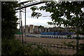

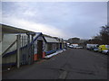

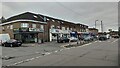
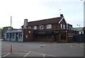
39 photos from this area
Area Information
Key information about the SL2 5NF including its size, population, and administrative classification.
- Area Type
- Postcode
- Area Size
- 7441 m²
- Population
- 2088
- Population Density
- 10082 people/km²
House Prices in SL2 5NF
37
Properties
£119,638
Average Sold Price
£32,500
Lowest Price
£190,000
Highest Price
Showing 37 properties
| Address | Type | Beds | Baths | Last Sale Price | Last Sale Date | |
|---|---|---|---|---|---|---|
| 97 Victoria Road, Slough, SL2 5NF | Flat | 1 | 1 | £180,000 | Jul 2022 | |
| 87 Victoria Road, Slough, SL2 5NF | Flat | 1 | 1 | £137,500 | May 2022 | |
| 63 Victoria Road, Slough, SL2 5NF | Flat | 1 | - | £135,000 | Apr 2022 | |
| 71 Victoria Road, Slough, SL2 5NF | Flat | - | - | £130,000 | Oct 2021 | |
| 39 Victoria Road, Slough, SL2 5NF | Flat | - | - | £124,000 | Aug 2021 | |
| 93 Victoria Road, Slough, SL2 5NF | Flat | - | - | £132,000 | Mar 2020 | |
| 73 Victoria Road, Slough, SL2 5NF | Flat | - | - | £165,000 | Dec 2019 | |
| 59 Victoria Road, Slough, SL2 5NF | Flat | 1 | 1 | £141,000 | Apr 2019 | |
| 79 Victoria Road, Slough, SL2 5NF | Flat | 1 | 1 | £181,000 | Sep 2018 | |
| 81 Victoria Road, Slough, SL2 5NF | Flat | 1 | 1 | £182,000 | Aug 2018 |
Page 1 of 4
Energy Efficiency in SL2 5NF
Amenities
Schools
| Rank | School | Type | Entry gender | Ages |
|---|
Explore more schools in this area
Go to Schools tabDemographics
Household Size
Family (3-5 people)
most common
Accommodation Type
Houses
most common
Tenure
56
majority
Ethnic Group
asian_total
most common
Religion
N/A
most common
Household Composition
N/A
most common
Age
47
median
Adults (30-64 years)
most common
Household Deprivation
N/A
with no deprivation
NS-SEC
22
in Lower managerial occupations
Explore more demographic insights in this area
Go to Demographics tabPlanning
Planning Constraints
- Flood RiskPremium
- Ramsar Wetland SitesPremium
- Area of Outstanding Natural BeautyPremium
- Protected Nature ReservePremium
- Protected WoodlandPremium