Area Overview for SL2 5JB
Photos of SL2 5JB


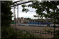

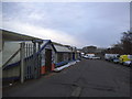
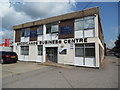
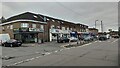
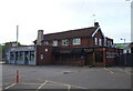
39 photos from this area
Area Information
Key information about the SL2 5JB including its size, population, and administrative classification.
- Area Type
- Postcode
- Area Size
- 6995 m²
- Population
- 2079
- Population Density
- 6338 people/km²
House Prices in SL2 5JB
18
Properties
£195,458
Average Sold Price
£79,000
Lowest Price
£418,000
Highest Price
Showing 18 properties
| Address | Type | Beds | Baths | Last Sale Price | Last Sale Date | |
|---|---|---|---|---|---|---|
| 2 Kendal Drive, Slough, SL2 5JB | house | - | - | £418,000 | Jan 2019 | |
| 10 Kendal Drive, Slough, SL2 5JB | house | 3 | 1 | £249,999 | Oct 2013 | |
| 28 Kendal Drive, Slough, SL2 5JB | house | - | - | £201,120 | Dec 2007 | |
| 8 Kendal Drive, Slough, SL2 5JB | house | - | - | £240,000 | Nov 2004 | |
| 6 Kendal Drive, Slough, SL2 5JB | Semi-detached | - | - | £160,000 | Nov 2001 | |
| 14 Kendal Drive, Slough, SL2 5JB | house | - | - | £156,000 | Apr 2000 | |
| 36 Kendal Drive, Slough, SL2 5JB | Semi-detached | - | - | £175,000 | Dec 1998 | |
| 32 Kendal Drive, Slough, SL2 5JB | Detached | 6 | 3 | £80,000 | Sep 1997 | |
| 20 Kendal Drive, Slough, SL2 5JB | house | - | - | £79,000 | Feb 1996 | |
| 12 Kendal Drive, Slough, SL2 5JB | Terraced | - | - | - | - |
Page 1 of 2
Energy Efficiency in SL2 5JB
Amenities
Schools
| Rank | School | Type | Entry gender | Ages |
|---|
Explore more schools in this area
Go to Schools tabDemographics
Household Size
Family (3-5 people)
most common
Accommodation Type
Houses
most common
Tenure
62
majority
Ethnic Group
asian_total
most common
Religion
N/A
most common
Household Composition
N/A
most common
Age
47
median
Adults (30-64 years)
most common
Household Deprivation
N/A
with no deprivation
NS-SEC
22
in Lower managerial occupations
Explore more demographic insights in this area
Go to Demographics tabPlanning
Planning Constraints
- Flood RiskPremium
- Ramsar Wetland SitesPremium
- Area of Outstanding Natural BeautyPremium
- Protected Nature ReservePremium
- Protected WoodlandPremium