Area Overview for SL2 3GW
Photos of SL2 3GW
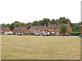
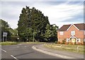
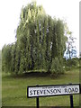
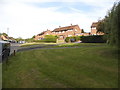
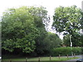
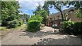
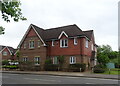
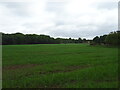
15 photos from this area
Area Information
Key information about the SL2 3GW including its size, population, and administrative classification.
- Area Type
- Postcode
- Area Size
- 1.9 hectares
- Population
- 1922
- Population Density
- 1388 people/km²
House Prices in SL2 3GW
60
Properties
£399,313
Average Sold Price
£118,000
Lowest Price
£787,500
Highest Price
Showing 60 properties
| Address | Type | Beds | Baths | Last Sale Price | Last Sale Date | |
|---|---|---|---|---|---|---|
| 58 Cranwells Lane, Farnham Common, SL2 3GW | Semi-detached | 4 | 2 | £775,000 | Nov 2025 | |
| 9 Cranwells Lane, Farnham Common, SL2 3GW | house | 4 | 3 | £787,500 | Aug 2025 | |
| 6 Cranwells Lane, Farnham Common, SL2 3GW | Flat | 2 | 2 | £308,500 | Aug 2025 | |
| 25 Cranwells Lane, Farnham Common, SL2 3GW | Flat | 2 | - | £325,000 | Dec 2024 | |
| 41 Cranwells Lane, Farnham Common, SL2 3GW | Flat | - | - | £380,000 | May 2024 | |
| 57 Cranwells Lane, Farnham Common, SL2 3GW | Semi-detached | 4 | 2 | £742,500 | Feb 2024 | |
| 14 Cranwells Lane, Farnham Common, SL2 3GW | Flat | 2 | - | £325,000 | Feb 2024 | |
| 43 Cranwells Lane, Farnham Common, SL2 3GW | Flat | - | - | £375,000 | Apr 2023 | |
| 44 Cranwells Lane, Farnham Common, SL2 3GW | Flat | 2 | 2 | £370,000 | Sep 2022 | |
| 15 Cranwells Lane, Farnham Common, SL2 3GW | Flat | 2 | - | £285,000 | May 2022 |
Page 1 of 6
Energy Efficiency in SL2 3GW
Amenities
Schools
| Rank | School | Type | Entry gender | Ages |
|---|
Explore more schools in this area
Go to Schools tabDemographics
Household Size
Family (3-5 people)
most common
Accommodation Type
Houses
most common
Tenure
85
majority
Ethnic Group
White
most common
Religion
N/A
most common
Household Composition
N/A
most common
Age
47
median
Adults (30-64 years)
most common
Household Deprivation
N/A
with no deprivation
NS-SEC
53
in Lower managerial occupations
Explore more demographic insights in this area
Go to Demographics tabPlanning
Planning Constraints
- Flood RiskPremium
- Ramsar Wetland SitesPremium
- Area of Outstanding Natural BeautyPremium
- Protected Nature ReservePremium
- Protected WoodlandPremium