Area Overview for SL2 2JS
Photos of SL2 2JS
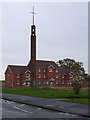
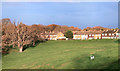
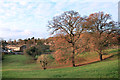
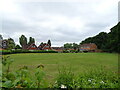
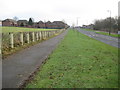
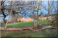
20 photos from this area
Area Information
Key information about the SL2 2JS including its size, population, and administrative classification.
- Area Type
- Postcode
- Area Size
- 5135 m²
- Population
- 2106
- Population Density
- 7232 people/km²
House Prices in SL2 2JS
15
Properties
£279,179
Average Sold Price
£56,000
Lowest Price
£421,000
Highest Price
Showing 15 properties
| Address | Type | Beds | Baths | Last Sale Price | Last Sale Date | |
|---|---|---|---|---|---|---|
| 38 Tomlin Road, Slough, SL2 2JS | Terraced | 3 | 1 | £421,000 | Jan 2025 | |
| 30 Tomlin Road, Slough, SL2 2JS | Flat | 1 | - | £175,000 | Apr 2024 | |
| 12 Tomlin Road, Slough, SL2 2JS | Terraced | 2 | 1 | £357,700 | Jun 2023 | |
| 28 Tomlin Road, Slough, SL2 2JS | Terraced | 3 | 1 | £340,000 | Mar 2021 | |
| 16 Tomlin Road, Slough, SL2 2JS | Terraced | 3 | 1 | £332,500 | Oct 2019 | |
| 18 Tomlin Road, Slough, SL2 2JS | Terraced | 2 | 1 | £290,000 | Jul 2019 | |
| 10 Tomlin Road, Slough, SL2 2JS | Terraced | 3 | 1 | £325,000 | Sep 2018 | |
| 24 Tomlin Road, Slough, SL2 2JS | Terraced | 3 | 1 | £327,450 | May 2018 | |
| 34 Tomlin Road, Slough, SL2 2JS | Terraced | 3 | 2 | £343,000 | Feb 2018 | |
| 26 Tomlin Road, Slough, SL2 2JS | Terraced | 2 | 1 | £250,000 | Apr 2016 |
Page 1 of 2
Energy Efficiency in SL2 2JS
Amenities
Schools
| Rank | School | Type | Entry gender | Ages |
|---|
Explore more schools in this area
Go to Schools tabDemographics
Household Size
Family (3-5 people)
most common
Accommodation Type
Houses
most common
Tenure
56
majority
Ethnic Group
White
most common
Religion
N/A
most common
Household Composition
N/A
most common
Age
47
median
Adults (30-64 years)
most common
Household Deprivation
N/A
with no deprivation
NS-SEC
29
in Lower managerial occupations
Explore more demographic insights in this area
Go to Demographics tabPlanning
Planning Constraints
- Flood RiskPremium
- Ramsar Wetland SitesPremium
- Area of Outstanding Natural BeautyPremium
- Protected Nature ReservePremium
- Protected WoodlandPremium