Area Overview for SL2 2EG
Photos of SL2 2EG
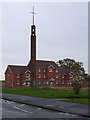
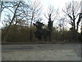
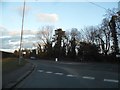
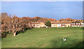
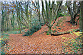
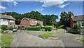
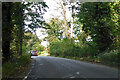
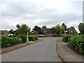
20 photos from this area
Area Information
Key information about the SL2 2EG including its size, population, and administrative classification.
- Area Type
- Postcode
- Area Size
- 7090 m²
- Population
- 1658
- Population Density
- 6173 people/km²
House Prices in SL2 2EG
23
Properties
£226,995
Average Sold Price
£162,000
Lowest Price
£340,000
Highest Price
Showing 23 properties
| Address | Type | Beds | Baths | Last Sale Price | Last Sale Date | |
|---|---|---|---|---|---|---|
| 182 Rokesby Road, Slough, SL2 2EG | Terraced | 2 | 1 | £340,000 | Mar 2023 | |
| 168 Rokesby Road, Slough, SL2 2EG | Terraced | 3 | 1 | £323,000 | May 2019 | |
| 170 Rokesby Road, Slough, SL2 2EG | Terraced | 3 | 1 | £308,950 | Jan 2016 | |
| 184 Rokesby Road, Slough, SL2 2EG | Terraced | 3 | 1 | £220,000 | Jan 2014 | |
| 178 Rokesby Road, Slough, SL2 2EG | house | - | - | £184,000 | Nov 2013 | |
| 176 Rokesby Road, Slough, SL2 2EG | house | - | - | £192,000 | Sep 2013 | |
| 164 Rokesby Road, Slough, SL2 2EG | house | - | - | £162,000 | Jul 2012 | |
| 162 Rokesby Road, Slough, SL2 2EG | Terraced | - | - | £185,000 | Feb 2008 | |
| 174 Rokesby Road, Slough, SL2 2EG | Terraced | - | - | £190,000 | Sep 2007 | |
| 186 Rokesby Road, Slough, SL2 2EG | Terraced | 3 | 1 | £165,000 | Jul 2006 |
Page 1 of 3
Energy Efficiency in SL2 2EG
Amenities
Schools
| Rank | School | Type | Entry gender | Ages |
|---|
Explore more schools in this area
Go to Schools tabDemographics
Household Size
Family (3-5 people)
most common
Accommodation Type
Houses
most common
Tenure
53
majority
Ethnic Group
White
most common
Religion
N/A
most common
Household Composition
N/A
most common
Age
47
median
Adults (30-64 years)
most common
Household Deprivation
N/A
with no deprivation
NS-SEC
26
in Lower managerial occupations
Explore more demographic insights in this area
Go to Demographics tabPlanning
Planning Constraints
- Flood RiskPremium
- Ramsar Wetland SitesPremium
- Area of Outstanding Natural BeautyPremium
- Protected Nature ReservePremium
- Protected WoodlandPremium