Area Overview for SL2 1QT
Photos of SL2 1QT
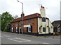
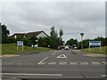
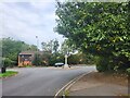
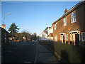
18 photos from this area
Area Information
Key information about the SL2 1QT including its size, population, and administrative classification.
- Area Type
- Postcode
- Area Size
- 2.1 hectares
- Population
- 1960
- Population Density
- 7182 people/km²
House Prices in SL2 1QT
18
Properties
£182,045
Average Sold Price
£76,500
Lowest Price
£325,000
Highest Price
Showing 18 properties
| Address | Type | Beds | Baths | Last Sale Price | Last Sale Date | |
|---|---|---|---|---|---|---|
| 74 Monksfield Way, Slough, SL2 1QT | Terraced | 3 | 1 | £320,000 | Jun 2023 | |
| 76 Monksfield Way, Slough, SL2 1QT | house | - | - | £325,000 | Apr 2021 | |
| 80 Monksfield Way, Slough, SL2 1QT | Terraced | 3 | 1 | £310,000 | Jan 2017 | |
| 92 Monksfield Way, Slough, SL2 1QT | house | - | - | £159,000 | Jan 2014 | |
| 98 Monksfield Way, Slough, SL2 1QT | Terraced | 3 | 2 | £168,000 | Oct 2012 | |
| 100 Monksfield Way, Slough, SL2 1QT | Terraced | - | - | £135,950 | Jan 2003 | |
| 70 Monksfield Way, Slough, SL2 1QT | house | - | - | £115,000 | Apr 2002 | |
| 84 Monksfield Way, Slough, SL2 1QT | house | - | - | £133,000 | May 2001 | |
| 90 Monksfield Way, Slough, SL2 1QT | house | - | - | £78,000 | Mar 2000 | |
| 72 Monksfield Way, Slough, SL2 1QT | Terraced | - | - | £76,500 | Aug 1999 |
Page 1 of 2
Energy Efficiency in SL2 1QT
Amenities
Schools
| Rank | School | Type | Entry gender | Ages |
|---|
Explore more schools in this area
Go to Schools tabDemographics
Household Size
Family (3-5 people)
most common
Accommodation Type
Houses
most common
Tenure
53
majority
Ethnic Group
White
most common
Religion
N/A
most common
Household Composition
N/A
most common
Age
47
median
Adults (30-64 years)
most common
Household Deprivation
N/A
with no deprivation
NS-SEC
23
in Lower managerial occupations
Explore more demographic insights in this area
Go to Demographics tabPlanning
Planning Constraints
- Flood RiskPremium
- Ramsar Wetland SitesPremium
- Area of Outstanding Natural BeautyPremium
- Protected Nature ReservePremium
- Protected WoodlandPremium