Area Overview for SL2 1LG
Photos of SL2 1LG
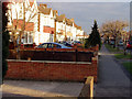
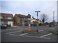
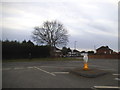
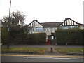
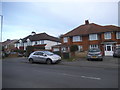

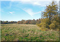
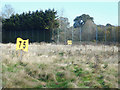
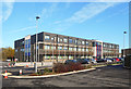
17 photos from this area
Area Information
Key information about the SL2 1LG including its size, population, and administrative classification.
- Area Type
- Postcode
- Area Size
- 8981 m²
- Population
- 1755
- Population Density
- 10914 people/km²
House Prices in SL2 1LG
35
Properties
£202,172
Average Sold Price
£43,000
Lowest Price
£442,000
Highest Price
Showing 35 properties
| Address | Type | Beds | Baths | Last Sale Price | Last Sale Date | |
|---|---|---|---|---|---|---|
| 40 Bryant Avenue, Slough, SL2 1LG | Terraced | 4 | 2 | £442,000 | Apr 2022 | |
| 28 Bryant Avenue, Slough, SL2 1LG | house | 3 | 1 | £338,000 | Mar 2021 | |
| 26 Bryant Avenue, Slough, SL2 1LG | Terraced | 3 | - | £360,000 | Mar 2018 | |
| 58 Bryant Avenue, Slough, SL2 1LG | Semi-detached | 3 | - | £326,000 | Feb 2018 | |
| 52 Bryant Avenue, Slough, SL2 1LG | house | - | - | £320,000 | Dec 2016 | |
| 44 Bryant Avenue, Slough, SL2 1LG | Terraced | 3 | - | £167,000 | Nov 2012 | |
| 64 Bryant Avenue, Slough, SL2 1LG | Terraced | 3 | 3 | £173,500 | Oct 2012 | |
| 8 Bryant Avenue, Slough, SL2 1LG | house | - | - | £200,000 | Oct 2010 | |
| 62 Bryant Avenue, Slough, SL2 1LG | house | - | - | £180,000 | Jul 2010 | |
| 42 Bryant Avenue, Slough, SL2 1LG | house | - | - | £208,000 | Feb 2010 |
Page 1 of 4
Energy Efficiency in SL2 1LG
Amenities
Schools
| Rank | School | Type | Entry gender | Ages |
|---|
Explore more schools in this area
Go to Schools tabDemographics
Household Size
Family (3-5 people)
most common
Accommodation Type
Houses
most common
Tenure
53
majority
Ethnic Group
asian_total
most common
Religion
N/A
most common
Household Composition
N/A
most common
Age
47
median
Adults (30-64 years)
most common
Household Deprivation
N/A
with no deprivation
NS-SEC
17
in Lower managerial occupations
Explore more demographic insights in this area
Go to Demographics tabPlanning
Planning Constraints
- Flood RiskPremium
- Ramsar Wetland SitesPremium
- Area of Outstanding Natural BeautyPremium
- Protected Nature ReservePremium
- Protected WoodlandPremium