Area Overview for SL1 7BH
Photos of SL1 7BH
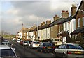
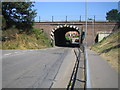
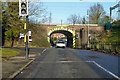
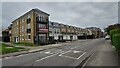
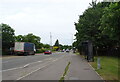
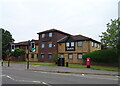
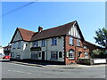
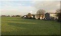
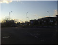
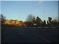
29 photos from this area
Area Information
Key information about the SL1 7BH including its size, population, and administrative classification.
- Area Type
- Postcode
- Area Size
- 8225 m²
- Population
- 1643
- Population Density
- 4789 people/km²
House Prices in SL1 7BH
25
Properties
£384,809
Average Sold Price
£215,000
Lowest Price
£750,000
Highest Price
Showing 25 properties
| Address | Type | Beds | Baths | Last Sale Price | Last Sale Date | |
|---|---|---|---|---|---|---|
| 128 Lent Rise Road, Burnham, SL1 7BH | Terraced | 3 | 1 | £390,000 | May 2023 | |
| 132A Lent Rise Road, Burnham, SL1 7BH | Retail | 4 | 2 | £518,000 | Oct 2022 | |
| 126A Lent Rise Road, Burnham, SL1 7BH | Cottage | 2 | 2 | £360,000 | Nov 2021 | |
| 142 Lent Rise Road, Burnham, SL1 7BH | house | - | - | £750,000 | Jun 2021 | |
| 112 Lent Rise Road, Burnham, SL1 7BH | house | - | - | £410,000 | Nov 2020 | |
| 106 Lent Rise Road, Burnham, SL1 7BH | Semi-detached | 2 | 1 | £420,000 | Nov 2020 | |
| 140 Lent Rise Road, Burnham, SL1 7BH | Detached | 4 | 3 | £525,000 | Apr 2015 | |
| 136 Lent Rise Road, Burnham, SL1 7BH | Detached | 5 | 3 | £493,000 | Dec 2013 | |
| 110 Lent Rise Road, Burnham, SL1 7BH | house | 5 | - | £340,000 | Mar 2011 | |
| 126 Lent Rise Road, Burnham, SL1 7BH | Detached | 4 | 2 | £385,000 | Jun 2010 |
Page 1 of 3
Energy Efficiency in SL1 7BH
Amenities
Schools
| Rank | School | Type | Entry gender | Ages |
|---|
Explore more schools in this area
Go to Schools tabDemographics
Household Size
Family (3-5 people)
most common
Accommodation Type
Houses
most common
Tenure
59
majority
Ethnic Group
White
most common
Religion
N/A
most common
Household Composition
N/A
most common
Age
47
median
Adults (30-64 years)
most common
Household Deprivation
N/A
with no deprivation
NS-SEC
38
in Lower managerial occupations
Explore more demographic insights in this area
Go to Demographics tabPlanning
Planning Constraints
- Flood RiskPremium
- Ramsar Wetland SitesPremium
- Area of Outstanding Natural BeautyPremium
- Protected Nature ReservePremium
- Protected WoodlandPremium