Area Overview for SL1 6EZ
Photos of SL1 6EZ


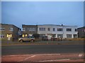

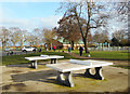
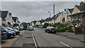


37 photos from this area
Area Information
Key information about the SL1 6EZ including its size, population, and administrative classification.
- Area Type
- Postcode
- Area Size
- 9496 m²
- Population
- 1995
- Population Density
- 7658 people/km²
House Prices in SL1 6EZ
68
Properties
£281,323
Average Sold Price
£155,000
Lowest Price
£535,000
Highest Price
Showing 68 properties
| Address | Type | Beds | Baths | Last Sale Price | Last Sale Date | |
|---|---|---|---|---|---|---|
| 34 Eaton Avenue, Slough, SL1 6EZ | Flat | 2 | 2 | £255,000 | May 2025 | |
| 25 Eaton Avenue, Slough, SL1 6EZ | Flat | 2 | 2 | £182,000 | Oct 2024 | |
| 61 Eaton Avenue, Slough, SL1 6EZ | Terraced | 3 | 2 | £418,000 | Oct 2024 | |
| 12 Eaton Avenue, Slough, SL1 6EZ | Flat | - | - | £254,000 | Jun 2024 | |
| 66 Eaton Avenue, Slough, SL1 6EZ | house | - | - | £525,000 | Jan 2024 | |
| 29 Eaton Avenue, Slough, SL1 6EZ | Flat | 2 | - | £275,000 | Jun 2023 | |
| 62 Eaton Avenue, Slough, SL1 6EZ | Terraced | 3 | 2 | £425,000 | May 2023 | |
| 68 Eaton Avenue, Slough, SL1 6EZ | Terraced | 2 | 2 | £310,000 | Mar 2023 | |
| 11 Eaton Avenue, Slough, SL1 6EZ | Flat | 2 | 2 | £190,000 | Mar 2023 | |
| 36 Eaton Avenue, Slough, SL1 6EZ | Flat | - | - | £232,500 | Nov 2022 |
Page 1 of 7
Energy Efficiency in SL1 6EZ
Amenities
Schools
| Rank | School | Type | Entry gender | Ages |
|---|
Explore more schools in this area
Go to Schools tabDemographics
Household Size
Family (3-5 people)
most common
Accommodation Type
Houses
most common
Tenure
72
majority
Ethnic Group
White
most common
Religion
N/A
most common
Household Composition
N/A
most common
Age
47
median
Adults (30-64 years)
most common
Household Deprivation
N/A
with no deprivation
NS-SEC
35
in Lower managerial occupations
Explore more demographic insights in this area
Go to Demographics tabPlanning
Planning Constraints
- Flood RiskPremium
- Ramsar Wetland SitesPremium
- Area of Outstanding Natural BeautyPremium
- Protected Nature ReservePremium
- Protected WoodlandPremium