Area Overview for SL1 6ET
Photos of SL1 6ET
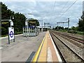
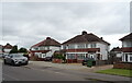
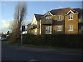
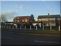
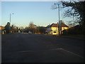
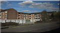
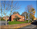
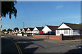
25 photos from this area
Area Information
Key information about the SL1 6ET including its size, population, and administrative classification.
- Area Type
- Postcode
- Area Size
- 1.1 hectares
- Population
- 1423
- Population Density
- 4976 people/km²
House Prices in SL1 6ET
19
Properties
£428,532
Average Sold Price
£250,000
Lowest Price
£600,000
Highest Price
Showing 19 properties
| Address | Type | Beds | Baths | Last Sale Price | Last Sale Date | |
|---|---|---|---|---|---|---|
| 27 Crosthwaite Way, Slough, SL1 6ET | Bungalow | - | - | £468,000 | Dec 2020 | |
| 9 Crosthwaite Way, Slough, SL1 6ET | Bungalow | 5 | 3 | £600,000 | Jan 2020 | |
| 15 Crosthwaite Way, Slough, SL1 6ET | Bungalow | - | - | £545,000 | May 2018 | |
| 33 Crosthwaite Way, Slough, SL1 6ET | Bungalow | 5 | 3 | £550,000 | Jul 2017 | |
| 1 Crosthwaite Way, Slough, SL1 6ET | Bungalow | 3 | 1 | £395,000 | Mar 2016 | |
| 1B Crosthwaite Way, Slough, SL1 6ET | Detached | 4 | 1 | £485,000 | Dec 2013 | |
| 23 Crosthwaite Way, Slough, SL1 6ET | Bungalow | - | - | £250,000 | Sep 2012 | |
| 19 Crosthwaite Way, Slough, SL1 6ET | Bungalow | 3 | - | £283,790 | Feb 2012 | |
| 29 Crosthwaite Way, Slough, SL1 6ET | Detached | - | - | £280,000 | Nov 2006 | |
| 13 Crosthwaite Way, Slough, SL1 6ET | Bungalow | 3 | 2 | - | - |
Page 1 of 2
Energy Efficiency in SL1 6ET
Amenities
Schools
| Rank | School | Type | Entry gender | Ages |
|---|
Explore more schools in this area
Go to Schools tabDemographics
Household Size
Family (3-5 people)
most common
Accommodation Type
Houses
most common
Tenure
85
majority
Ethnic Group
asian_total
most common
Religion
N/A
most common
Household Composition
N/A
most common
Age
47
median
Adults (30-64 years)
most common
Household Deprivation
N/A
with no deprivation
NS-SEC
41
in Lower managerial occupations
Explore more demographic insights in this area
Go to Demographics tabPlanning
Planning Constraints
- Flood RiskPremium
- Ramsar Wetland SitesPremium
- Area of Outstanding Natural BeautyPremium
- Protected Nature ReservePremium
- Protected WoodlandPremium