Area Overview for SL1 6EF
Photos of SL1 6EF
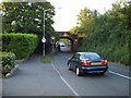
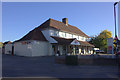
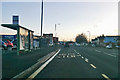
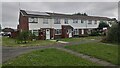
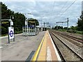
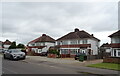
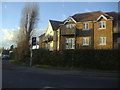
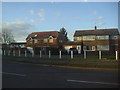
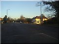
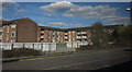
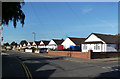
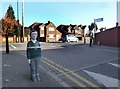
25 photos from this area
Area Information
Key information about the SL1 6EF including its size, population, and administrative classification.
- Area Type
- Postcode
- Area Size
- 7778 m²
- Population
- 1372
- Population Density
- 6343 people/km²
House Prices in SL1 6EF
25
Properties
£178,250
Average Sold Price
£48,000
Lowest Price
£380,000
Highest Price
Showing 25 properties
| Address | Type | Beds | Baths | Last Sale Price | Last Sale Date | |
|---|---|---|---|---|---|---|
| 35 Buttermere Avenue, Slough, SL1 6EF | Bungalow | - | - | £380,000 | Apr 2023 | |
| 29 Buttermere Avenue, Slough, SL1 6EF | Maisonette | 2 | 1 | £280,000 | May 2018 | |
| 69 Buttermere Avenue, Slough, SL1 6EF | Flat | - | - | £245,000 | Jul 2017 | |
| 63 Buttermere Avenue, Slough, SL1 6EF | Semi-detached | 2 | 1 | £245,000 | Jan 2014 | |
| 71 Buttermere Avenue, Slough, SL1 6EF | Flat | 2 | - | £160,000 | Oct 2012 | |
| 17 Buttermere Avenue, Slough, SL1 6EF | Flat | 2 | 1 | £105,000 | Aug 2009 | |
| 11 Buttermere Avenue, Slough, SL1 6EF | Flat | 2 | 1 | £147,000 | Dec 2007 | |
| 26A Buttermere Avenue, Slough, SL1 6EF | Terraced | 3 | 1 | £186,000 | May 2006 | |
| 9 Buttermere Avenue, Slough, SL1 6EF | Flat | - | - | £140,000 | Nov 2003 | |
| 19 Buttermere Avenue, Slough, SL1 6EF | Flat | 2 | 1 | £67,000 | Sep 2003 |
Page 1 of 3
Energy Efficiency in SL1 6EF
Amenities
Schools
| Rank | School | Type | Entry gender | Ages |
|---|
Explore more schools in this area
Go to Schools tabDemographics
Household Size
Family (3-5 people)
most common
Accommodation Type
Flats
most common
Tenure
46
majority
Ethnic Group
White
most common
Religion
N/A
most common
Household Composition
N/A
most common
Age
47
median
Adults (30-64 years)
most common
Household Deprivation
N/A
with no deprivation
NS-SEC
30
in Lower managerial occupations
Explore more demographic insights in this area
Go to Demographics tabPlanning
Planning Constraints
- Flood RiskPremium
- Ramsar Wetland SitesPremium
- Area of Outstanding Natural BeautyPremium
- Protected Nature ReservePremium
- Protected WoodlandPremium