Area Overview for SL1 5DW
Photos of SL1 5DW
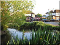
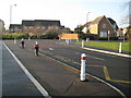
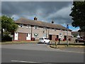
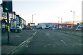
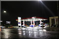
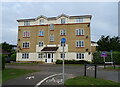
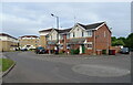
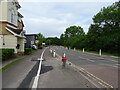
24 photos from this area
Area Information
Key information about the SL1 5DW including its size, population, and administrative classification.
- Area Type
- Postcode
- Area Size
- 1.2 hectares
- Population
- 1775
- Population Density
- 6321 people/km²
House Prices in SL1 5DW
30
Properties
£317,653
Average Sold Price
£185,000
Lowest Price
£630,000
Highest Price
Showing 30 properties
| Address | Type | Beds | Baths | Last Sale Price | Last Sale Date | |
|---|---|---|---|---|---|---|
| 76 Lower Cippenham Lane, Slough, SL1 5DW | Retail | 3 | 1 | £525,000 | Sep 2022 | |
| 96 Lower Cippenham Lane, Slough, SL1 5DW | house | - | - | £370,000 | Jul 2021 | |
| 110 Lower Cippenham Lane, Slough, SL1 5DW | Terraced | 3 | 2 | £382,000 | Apr 2021 | |
| 104 Lower Cippenham Lane, Slough, SL1 5DW | Terraced | 2 | 2 | £317,000 | Mar 2021 | |
| 84 Lower Cippenham Lane, Slough, SL1 5DW | Bungalow | - | - | £630,000 | Mar 2021 | |
| 78 Lower Cippenham Lane, Slough, SL1 5DW | Bungalow | 3 | - | £475,000 | Oct 2016 | |
| 106 Lower Cippenham Lane, Slough, SL1 5DW | Cottage | 3 | 2 | £265,000 | Dec 2014 | |
| 80 Lower Cippenham Lane, Slough, SL1 5DW | Bungalow | - | - | £310,000 | Aug 2012 | |
| 86 Lower Cippenham Lane, Slough, SL1 5DW | Bungalow | - | - | £325,000 | Nov 2010 | |
| 102 Lower Cippenham Lane, Slough, SL1 5DW | house | 2 | - | £202,500 | Apr 2010 |
Page 1 of 3
Energy Efficiency in SL1 5DW
Amenities
Schools
| Rank | School | Type | Entry gender | Ages |
|---|
Explore more schools in this area
Go to Schools tabDemographics
Household Size
Family (3-5 people)
most common
Accommodation Type
Houses
most common
Tenure
62
majority
Ethnic Group
White
most common
Religion
N/A
most common
Household Composition
N/A
most common
Age
47
median
Adults (30-64 years)
most common
Household Deprivation
N/A
with no deprivation
NS-SEC
32
in Lower managerial occupations
Explore more demographic insights in this area
Go to Demographics tabPlanning
Planning Constraints
- Flood RiskPremium
- Ramsar Wetland SitesPremium
- Area of Outstanding Natural BeautyPremium
- Protected Nature ReservePremium
- Protected WoodlandPremium