Area Overview for SL1 3TH
Photos of SL1 3TH


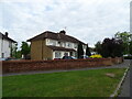
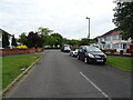
71 photos from this area
Area Information
Key information about the SL1 3TH including its size, population, and administrative classification.
- Area Type
- Postcode
- Area Size
- 2.4 hectares
- Population
- 2908
- Population Density
- 5274 people/km²
House Prices in SL1 3TH
52
Properties
£216,157
Average Sold Price
£68,000
Lowest Price
£610,000
Highest Price
Showing 52 properties
| Address | Type | Beds | Baths | Last Sale Price | Last Sale Date | |
|---|---|---|---|---|---|---|
| 50 Salt Hill Drive, Slough, SL1 3TH | Semi-detached | 5 | 3 | £610,000 | Nov 2023 | |
| 7C Salt Hill Drive, Slough, SL1 3TH | Maisonette | 2 | 1 | £210,000 | Dec 2021 | |
| 7D Salt Hill Drive, Slough, SL1 3TH | Detached | 1 | 1 | £188,000 | Sep 2021 | |
| 43 Salt Hill Drive, Slough, SL1 3TH | house | - | - | £420,000 | Oct 2019 | |
| 7B Salt Hill Drive, Slough, SL1 3TH | Maisonette | 2 | 1 | £160,000 | Jul 2015 | |
| 21 Salt Hill Drive, Slough, SL1 3TH | house | - | - | £150,000 | Sep 2014 | |
| 17 Salt Hill Drive, Slough, SL1 3TH | house | - | - | £200,000 | Jan 2013 | |
| 25 Salt Hill Drive, Slough, SL1 3TH | Semi-detached | 5 | 3 | £200,000 | Mar 2012 | |
| 13 Salt Hill Drive, Slough, SL1 3TH | Semi-detached | - | - | £226,000 | Oct 2008 | |
| 22 Salt Hill Drive, Slough, SL1 3TH | Semi-detached | - | - | £320,000 | May 2008 |
Page 1 of 6
Energy Efficiency in SL1 3TH
Amenities
Schools
| Rank | School | Type | Entry gender | Ages |
|---|
Explore more schools in this area
Go to Schools tabDemographics
Household Size
Family (3-5 people)
most common
Accommodation Type
Flats
most common
Tenure
38
majority
Ethnic Group
asian_total
most common
Religion
N/A
most common
Household Composition
N/A
most common
Age
47
median
Adults (30-64 years)
most common
Household Deprivation
N/A
with no deprivation
NS-SEC
21
in Lower managerial occupations
Explore more demographic insights in this area
Go to Demographics tabPlanning
Planning Constraints
- Flood RiskPremium
- Ramsar Wetland SitesPremium
- Area of Outstanding Natural BeautyPremium
- Protected Nature ReservePremium
- Protected WoodlandPremium