Area Overview for SL1 3NH
Photos of SL1 3NH
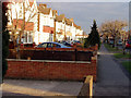
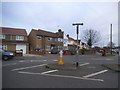
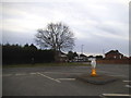
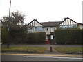
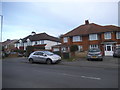

17 photos from this area
Area Information
Key information about the SL1 3NH including its size, population, and administrative classification.
- Area Type
- Postcode
- Area Size
- 6.3 hectares
- Population
- 1872
- Population Density
- 446 people/km²
House Prices in SL1 3NH
16
Properties
£215,256
Average Sold Price
£106,000
Lowest Price
£325,000
Highest Price
Showing 16 properties
| Address | Type | Beds | Baths | Last Sale Price | Last Sale Date | |
|---|---|---|---|---|---|---|
| 2 Stewart Avenue, Slough, SL1 3NH | Semi-detached | 2 | 1 | £325,000 | Dec 2018 | |
| 13 Stewart Avenue, Slough, SL1 3NH | house | - | - | £278,999 | Dec 2015 | |
| 5 Stewart Avenue, Slough, SL1 3NH | Semi-detached | 3 | - | £214,285 | Dec 2010 | |
| 6 Stewart Avenue, Slough, SL1 3NH | Semi-detached | - | - | £171,300 | Nov 2003 | |
| 16 Stewart Avenue, Slough, SL1 3NH | Terraced | - | - | £195,950 | Sep 2003 | |
| 15 Stewart Avenue, Slough, SL1 3NH | Terraced | - | - | £106,000 | Feb 2001 | |
| 4 Stewart Avenue, Slough, SL1 3NH | Detached | 2 | 1 | - | - | |
| 10 Stewart Avenue, Slough, SL1 3NH | Semi-detached | 3 | 1 | - | - | |
| 14 Stewart Avenue, Slough, SL1 3NH | house | - | - | - | - | |
| 1 Stewart Avenue, Slough, SL1 3NH | house | - | - | - | - |
Page 1 of 2
Energy Efficiency in SL1 3NH
Amenities
Schools
| Rank | School | Type | Entry gender | Ages |
|---|
Explore more schools in this area
Go to Schools tabDemographics
Household Size
Family (3-5 people)
most common
Accommodation Type
Houses
most common
Tenure
74
majority
Ethnic Group
White
most common
Religion
N/A
most common
Household Composition
N/A
most common
Age
47
median
Adults (30-64 years)
most common
Household Deprivation
N/A
with no deprivation
NS-SEC
44
in Lower managerial occupations
Explore more demographic insights in this area
Go to Demographics tabPlanning
Planning Constraints
- Flood RiskPremium
- Ramsar Wetland SitesPremium
- Area of Outstanding Natural BeautyPremium
- Protected Nature ReservePremium
- Protected WoodlandPremium