Area Overview for SL1 2YF
Photos of SL1 2YF

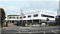
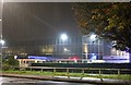
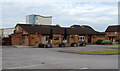
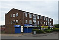
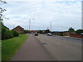

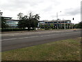
26 photos from this area
Area Information
Key information about the SL1 2YF including its size, population, and administrative classification.
- Area Type
- Postcode
- Area Size
- 5265 m²
- Population
- 2167
- Population Density
- 6417 people/km²
House Prices in SL1 2YF
19
Properties
£228,000
Average Sold Price
£136,000
Lowest Price
£390,000
Highest Price
Showing 19 properties
| Address | Type | Beds | Baths | Last Sale Price | Last Sale Date | |
|---|---|---|---|---|---|---|
| 21 Spinney, Slough, SL1 2YF | Terraced | 3 | 1 | £390,000 | Jun 2024 | |
| 31 Spinney, Slough, SL1 2YF | house | - | - | £350,000 | Jun 2021 | |
| 17 Spinney, Slough, SL1 2YF | Terraced | 3 | 1 | £350,000 | Feb 2020 | |
| 1 Spinney, Slough, SL1 2YF | house | 3 | 1 | £260,000 | Sep 2011 | |
| 19 Spinney, Slough, SL1 2YF | Terraced | - | - | £178,000 | May 2005 | |
| 23 Spinney, Slough, SL1 2YF | Terraced | - | - | £160,000 | Apr 2003 | |
| 7 Spinney, Slough, SL1 2YF | Semi-detached | - | - | £153,000 | Sep 2002 | |
| 5 Spinney, Slough, SL1 2YF | house | 3 | - | £162,000 | Aug 2002 | |
| 13 Spinney, Slough, SL1 2YF | Semi-detached | - | - | £141,000 | Jun 2002 | |
| 29 Spinney, Slough, SL1 2YF | house | 3 | 1 | £136,000 | Jun 2002 |
Page 1 of 2
Energy Efficiency in SL1 2YF
Amenities
Schools
| Rank | School | Type | Entry gender | Ages |
|---|
Explore more schools in this area
Go to Schools tabDemographics
Household Size
Family (3-5 people)
most common
Accommodation Type
Houses
most common
Tenure
42
majority
Ethnic Group
White
most common
Religion
N/A
most common
Household Composition
N/A
most common
Age
47
median
Adults (30-64 years)
most common
Household Deprivation
N/A
with no deprivation
NS-SEC
22
in Lower managerial occupations
Explore more demographic insights in this area
Go to Demographics tabPlanning
Planning Constraints
- Flood RiskPremium
- Ramsar Wetland SitesPremium
- Area of Outstanding Natural BeautyPremium
- Protected Nature ReservePremium
- Protected WoodlandPremium