Area Overview for SL1 2TT
Photos of SL1 2TT
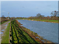
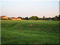


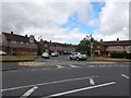
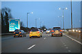
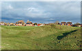
36 photos from this area
Area Information
Key information about the SL1 2TT including its size, population, and administrative classification.
- Area Type
- Postcode
- Area Size
- 8474 m²
- Population
- 1971
- Population Density
- 6185 people/km²
House Prices in SL1 2TT
26
Properties
£174,188
Average Sold Price
£71,500
Lowest Price
£380,000
Highest Price
Showing 26 properties
| Address | Type | Beds | Baths | Last Sale Price | Last Sale Date | |
|---|---|---|---|---|---|---|
| 22 Colin Way, Slough, SL1 2TT | Terraced | 3 | 1 | £380,000 | Nov 2024 | |
| 6 Colin Way, Slough, SL1 2TT | Terraced | 3 | 1 | £340,000 | Aug 2024 | |
| 11 Colin Way, Slough, SL1 2TT | house | - | - | £184,500 | Jun 2014 | |
| 5 Colin Way, Slough, SL1 2TT | Terraced | 3 | 1 | £194,000 | Jan 2014 | |
| 2 Colin Way, Slough, SL1 2TT | Terraced | 3 | 1 | £185,000 | Dec 2011 | |
| 19 Colin Way, Slough, SL1 2TT | house | - | - | £172,000 | Nov 2007 | |
| 23 Colin Way, Slough, SL1 2TT | Terraced | - | - | £172,000 | Dec 2006 | |
| 21 Colin Way, Slough, SL1 2TT | Terraced | - | - | £170,000 | Aug 2006 | |
| 7 Colin Way, Slough, SL1 2TT | Terraced | - | - | £157,000 | Jul 2005 | |
| 8 Colin Way, Slough, SL1 2TT | Terraced | - | - | £145,000 | May 2003 |
Page 1 of 3
Energy Efficiency in SL1 2TT
Amenities
Schools
| Rank | School | Type | Entry gender | Ages |
|---|
Explore more schools in this area
Go to Schools tabDemographics
Household Size
Family (3-5 people)
most common
Accommodation Type
Houses
most common
Tenure
59
majority
Ethnic Group
asian_total
most common
Religion
N/A
most common
Household Composition
N/A
most common
Age
47
median
Adults (30-64 years)
most common
Household Deprivation
N/A
with no deprivation
NS-SEC
29
in Lower managerial occupations
Explore more demographic insights in this area
Go to Demographics tabPlanning
Planning Constraints
- Flood RiskPremium
- Ramsar Wetland SitesPremium
- Area of Outstanding Natural BeautyPremium
- Protected Nature ReservePremium
- Protected WoodlandPremium