Area Overview for SL1 2TD
Photos of SL1 2TD
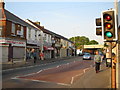


69 photos from this area
Area Information
Key information about the SL1 2TD including its size, population, and administrative classification.
- Area Type
- Postcode
- Area Size
- 5248 m²
- Population
- 2243
- Population Density
- 6582 people/km²
House Prices in SL1 2TD
16
Properties
£364,750
Average Sold Price
£128,000
Lowest Price
£850,000
Highest Price
Showing 16 properties
| Address | Type | Beds | Baths | Last Sale Price | Last Sale Date | |
|---|---|---|---|---|---|---|
| 163 Chalvey Grove, Slough, SL1 2TD | house | 3 | 1 | £375,000 | Jul 2024 | |
| 137 Chalvey Grove, Slough, SL1 2TD | Maisonette | 2 | 1 | £560,000 | Feb 2022 | |
| 165 Chalvey Grove, Slough, SL1 2TD | house | - | - | £850,000 | Jun 2018 | |
| 141A Chalvey Grove, Slough, SL1 2TD | Detached | - | - | £340,000 | Sep 2016 | |
| Former, 155 Chalvey Grove, Slough, SL1 2TD | Detached | - | - | £315,000 | May 2015 | |
| 139 Chalvey Grove, Slough, SL1 2TD | Bungalow | - | - | £150,000 | Dec 2009 | |
| 143 Chalvey Grove, Slough, SL1 2TD | Flat | 2 | 1 | £200,000 | Dec 2006 | |
| 161 Chalvey Grove, Slough, SL1 2TD | house | - | - | £128,000 | Nov 2001 | |
| 141 Chalvey Grove, Slough, SL1 2TD | Detached | - | - | - | - | |
| Former, 157 Chalvey Grove, Slough, SL1 2TD | Detached | - | - | - | - |
Page 1 of 2
Energy Efficiency in SL1 2TD
Amenities
Schools
| Rank | School | Type | Entry gender | Ages |
|---|
Explore more schools in this area
Go to Schools tabDemographics
Household Size
Family (3-5 people)
most common
Accommodation Type
Houses
most common
Tenure
52
majority
Ethnic Group
asian_total
most common
Religion
N/A
most common
Household Composition
N/A
most common
Age
47
median
Adults (30-64 years)
most common
Household Deprivation
N/A
with no deprivation
NS-SEC
22
in Lower managerial occupations
Explore more demographic insights in this area
Go to Demographics tabPlanning
Planning Constraints
- Flood RiskPremium
- Ramsar Wetland SitesPremium
- Area of Outstanding Natural BeautyPremium
- Protected Nature ReservePremium
- Protected WoodlandPremium