Area Overview for SL1 2SB
Photos of SL1 2SB
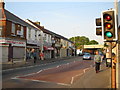
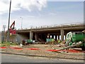
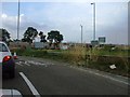
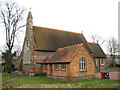


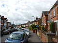
69 photos from this area
Area Information
Key information about the SL1 2SB including its size, population, and administrative classification.
- Area Type
- Postcode
- Area Size
- 1.2 hectares
- Population
- 2032
- Population Density
- 2955 people/km²
House Prices in SL1 2SB
42
Properties
£206,500
Average Sold Price
£48,500
Lowest Price
£420,000
Highest Price
Showing 42 properties
| Address | Type | Beds | Baths | Last Sale Price | Last Sale Date | |
|---|---|---|---|---|---|---|
| 142 Spackmans Way, Slough, SL1 2SB | house | - | - | £420,000 | Dec 2024 | |
| 180 Spackmans Way, Slough, SL1 2SB | house | 3 | 1 | £330,000 | Oct 2021 | |
| 120 Spackmans Way, Slough, SL1 2SB | house | - | - | £290,000 | Jun 2021 | |
| 92 Spackmans Way, Slough, SL1 2SB | Terraced | 3 | - | £325,000 | Mar 2018 | |
| 136 Spackmans Way, Slough, SL1 2SB | house | - | - | £235,000 | Feb 2012 | |
| 176 Spackmans Way, Slough, SL1 2SB | Terraced | - | - | £198,500 | Jun 2007 | |
| 184 Spackmans Way, Slough, SL1 2SB | Terraced | - | - | £127,000 | Aug 2006 | |
| 134 Spackmans Way, Slough, SL1 2SB | Terraced | - | - | £210,000 | Dec 2005 | |
| 78 Spackmans Way, Slough, SL1 2SB | house | - | - | £175,000 | Jun 2005 | |
| 138 Spackmans Way, Slough, SL1 2SB | house | - | - | £203,000 | Jul 2004 |
Page 1 of 5
Energy Efficiency in SL1 2SB
Amenities
Schools
| Rank | School | Type | Entry gender | Ages |
|---|
Explore more schools in this area
Go to Schools tabDemographics
Household Size
Family (3-5 people)
most common
Accommodation Type
Houses
most common
Tenure
39
majority
Ethnic Group
asian_total
most common
Religion
N/A
most common
Household Composition
N/A
most common
Age
47
median
Adults (30-64 years)
most common
Household Deprivation
N/A
with no deprivation
NS-SEC
18
in Lower managerial occupations
Explore more demographic insights in this area
Go to Demographics tabPlanning
Planning Constraints
- Flood RiskPremium
- Ramsar Wetland SitesPremium
- Area of Outstanding Natural BeautyPremium
- Protected Nature ReservePremium
- Protected WoodlandPremium