Area Overview for SL0 9AT
Photos of SL0 9AT
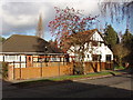
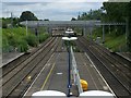
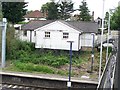
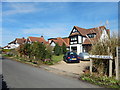

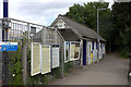
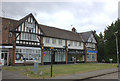
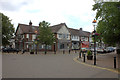
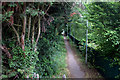

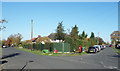
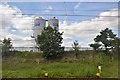
40 photos from this area
Area Information
Key information about the SL0 9AT including its size, population, and administrative classification.
- Area Type
- Postcode
- Area Size
- 3211 m²
- Population
- 2193
- Population Density
- 558 people/km²
House Prices in SL0 9AT
24
Properties
£212,672
Average Sold Price
£49,950
Lowest Price
£310,000
Highest Price
Showing 24 properties
| Address | Type | Beds | Baths | Last Sale Price | Last Sale Date | |
|---|---|---|---|---|---|---|
| 1, Wellesley Court, Bathurst Walk, Iver, SL0 9AT | Flat | - | - | £295,000 | Jul 2025 | |
| 9, Wellesley Court, Bathurst Walk, Iver, SL0 9AT | Flat | - | - | £285,000 | Apr 2024 | |
| 14, Wellesley Court, Bathurst Walk, Iver, SL0 9AT | Flat | - | - | £297,000 | Apr 2023 | |
| 2, Wellesley Court, Bathurst Walk, Iver, SL0 9AT | Flat | 2 | 1 | £300,000 | Sep 2022 | |
| 15, Wellesley Court, Bathurst Walk, Iver, SL0 9AT | Flat | - | - | £305,000 | Feb 2022 | |
| 24, Wellesley Court, Bathurst Walk, Iver, SL0 9AT | Flat | 2 | - | £305,000 | Feb 2018 | |
| 18, Wellesley Court, Bathurst Walk, Iver, SL0 9AT | Flat | 2 | 1 | £310,000 | Sep 2017 | |
| 3, Wellesley Court, Bathurst Walk, Iver, SL0 9AT | Flat | 2 | 1 | £305,000 | Jun 2017 | |
| 7, Wellesley Court, Bathurst Walk, Iver, SL0 9AT | Flat | 3 | 1 | £301,000 | Jan 2016 | |
| 20, Wellesley Court, Bathurst Walk, Iver, SL0 9AT | Flat | - | - | £240,000 | Dec 2014 |
Page 1 of 3
Energy Efficiency in SL0 9AT
Amenities
Schools
| Rank | School | Type | Entry gender | Ages |
|---|
Explore more schools in this area
Go to Schools tabDemographics
Household Size
Family (3-5 people)
most common
Accommodation Type
Houses
most common
Tenure
82
majority
Ethnic Group
asian_total
most common
Religion
N/A
most common
Household Composition
N/A
most common
Age
47
median
Adults (30-64 years)
most common
Household Deprivation
N/A
with no deprivation
NS-SEC
46
in Lower managerial occupations
Explore more demographic insights in this area
Go to Demographics tabPlanning
Planning Constraints
- Flood RiskPremium
- Ramsar Wetland SitesPremium
- Area of Outstanding Natural BeautyPremium
- Protected Nature ReservePremium
- Protected WoodlandPremium