Area Overview for SL0 0QG
Photos of SL0 0QG
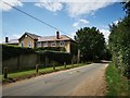
44 photos from this area
Area Information
Key information about the SL0 0QG including its size, population, and administrative classification.
- Area Type
- Postcode
- Area Size
- 3.6 hectares
- Population
- 1705
- Population Density
- 384 people/km²
House Prices in SL0 0QG
12
Properties
£461,333
Average Sold Price
£158,000
Lowest Price
£775,000
Highest Price
Showing 12 properties
| Address | Type | Beds | Baths | Last Sale Price | Last Sale Date | |
|---|---|---|---|---|---|---|
| Twyneham, Pinewood Green, Iver Heath, SL0 0QG | Semi-detached | 4 | 1 | £725,000 | Mar 2025 | |
| 40 Pinewood Green, Iver Heath, SL0 0QG | Semi-detached | 4 | 3 | £775,000 | Mar 2020 | |
| 36 Pinewood Green, Iver Heath, SL0 0QG | house | 3 | - | £340,000 | Feb 2013 | |
| Chilta End, Pinewood Green, Iver Heath, SL0 0QG | Semi-detached | - | - | £420,000 | Mar 2005 | |
| 46 Pinewood Green, Iver Heath, SL0 0QG | Detached | - | - | £350,000 | Jan 2004 | |
| The Hollies, Pinewood Green, Iver Heath, SL0 0QG | Semi-detached | - | - | £158,000 | Jun 1998 | |
| 34 Pinewood Green, Iver Heath, SL0 0QG | Semi-detached | 4 | - | - | - | |
| Tudor Lea, Pinewood Green, Iver Heath, SL0 0QG | Semi-detached | 3 | - | - | - | |
| The Maple, 42A Pinewood Green, Iver Heath, SL0 0QG | Semi-detached | 4 | 2 | - | - | |
| The Acorn, 42B Pinewood Green, Iver Heath, SL0 0QG | house | - | - | - | - |
Page 1 of 2
Energy Efficiency in SL0 0QG
Amenities
Schools
| Rank | School | Type | Entry gender | Ages |
|---|
Explore more schools in this area
Go to Schools tabDemographics
Household Size
Family (3-5 people)
most common
Accommodation Type
Houses
most common
Tenure
78
majority
Ethnic Group
White
most common
Religion
N/A
most common
Household Composition
N/A
most common
Age
47
median
Adults (30-64 years)
most common
Household Deprivation
N/A
with no deprivation
NS-SEC
44
in Lower managerial occupations
Explore more demographic insights in this area
Go to Demographics tabPlanning
Planning Constraints
- Flood RiskPremium
- Ramsar Wetland SitesPremium
- Area of Outstanding Natural BeautyPremium
- Protected Nature ReservePremium
- Protected WoodlandPremium