Area Overview for SL0 0BB
Photos of SL0 0BB
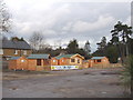
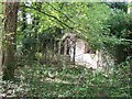
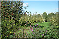
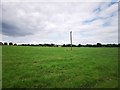
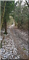
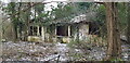
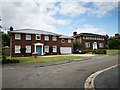
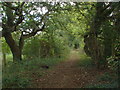
16 photos from this area
Area Information
Key information about the SL0 0BB including its size, population, and administrative classification.
- Area Type
- Postcode
- Area Size
- 19.3 hectares
- Population
- 1595
- Population Density
- 655 people/km²
House Prices in SL0 0BB
12
Properties
£590,600
Average Sold Price
£228,000
Lowest Price
£1,020,000
Highest Price
Showing 12 properties
| Address | Type | Beds | Baths | Last Sale Price | Last Sale Date | |
|---|---|---|---|---|---|---|
| Potterers Cottage, Bangors Road South, Iver, SL0 0BB | Detached | 4 | - | £1,020,000 | Mar 2018 | |
| Timber Grange, Bangors Road South, Iver, SL0 0BB | Detached | 4 | - | £730,000 | Nov 2014 | |
| Needwood Cottage, Bangors Road South, Iver, SL0 0BB | house | - | - | £440,000 | Jul 2004 | |
| Pentreath, Bangors Road South, Iver, SL0 0BB | Detached | - | - | £535,000 | Sep 1997 | |
| Dell Cottage, Bangors Road South, Iver, SL0 0BB | Detached | - | - | £228,000 | Aug 1995 | |
| Dreamsville, Bangors Road South, Iver, SL0 0BB | Detached | 5 | 4 | - | - | |
| Oaklands, Bangors Road South, Iver, SL0 0BB | Detached | 4 | 4 | - | - | |
| Tennis 55M From Pentreath, Bangors Road South 89M From Bangors Road South, Bangors Road South, Iver, SL0 0BB | Leisure | - | - | - | - | |
| Annexe, Oaklands, Bangors Road South, Iver, SL0 0BB | Flat | - | - | - | - | |
| Home Cottage, Bangors Road South, Iver, SL0 0BB | Detached | - | - | - | - |
Page 1 of 2
Energy Efficiency in SL0 0BB
Amenities
Schools
| Rank | School | Type | Entry gender | Ages |
|---|
Explore more schools in this area
Go to Schools tabDemographics
Household Size
Family (3-5 people)
most common
Accommodation Type
Houses
most common
Tenure
65
majority
Ethnic Group
White
most common
Religion
N/A
most common
Household Composition
N/A
most common
Age
47
median
Adults (30-64 years)
most common
Household Deprivation
N/A
with no deprivation
NS-SEC
33
in Lower managerial occupations
Explore more demographic insights in this area
Go to Demographics tabPlanning
Planning Constraints
- Flood RiskPremium
- Ramsar Wetland SitesPremium
- Area of Outstanding Natural BeautyPremium
- Protected Nature ReservePremium
- Protected WoodlandPremium