Area Overview for Sherwood Ward
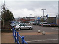
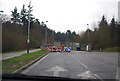
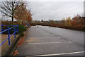
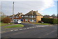
Photos of Sherwood Ward

Area Information
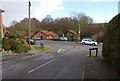
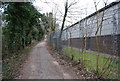
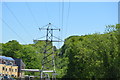
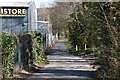
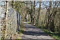
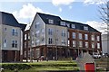
Sherwood Ward occupies a distinct position within Nottingham, covering a total area of 4.3 km². This district lies approximately 2.4 km north of the city centre, forming a substantial part of the unitary authority in the East Midlands region. The area serves as a borough-level ward that includes the neighbouring locality of Carrington. Its history dates back to the late nineteenth century, with significant development accelerating between 1870 and 1910 during the expansion of the lace industry. Architectural heritage from this era remains visible today, including carved stones on several buildings and structures like the 1900 Sherwood Bus Depot. Daily life here is shaped by its status as an established suburb that transformed from a hamlet into an integrated part of Nottingham in 1877. You will find a built environment rich with history, containing twenty-four Grade II listed buildings designed by Watson Fothergill. These include homes on Mansfield Road and the Scout War Memorial Gateway from 1927. The area offers a blend of residential peace with tangible historical depth, rather than the generic modern development found elsewhere. Living in Sherwood Ward means accessing a neighbourhood where infrastructure like the historic railway station opened in 1889 underpins the community structure. The setting is defined by its long-standing connection to industrial growth and subsequent suburban expansion, providing a stable local character.
- Area Type
- District Borough Unitary Ward
- Area Size
- 4.3 km²
- Population
- Not available
- Population Density
- Not available
Demographics
The community profile reveals a population with a median age of 70 years. This figure indicates a very mature demographic where the majority of residents belong to the oldest age bracket. You are looking at a neighbourhood where people typically value stability and local knowledge. Fifty-eight per cent of households in Sherwood Ward are owner-occupied, suggesting a strong sense of rootedness among current residents. This ownership rate is significantly higher than in younger urban areas. The health estate data shows total household composition and accommodation type metrics, confirming a settled residential environment. While specific breakdowns of individual age ranges or predominant ethnic groups are not itemised in the available records, the high median age defines the social fabric. This demographic skew means that schools or youth facilities are not the primary draw for this ward, unlike more youthful districts. Instead, the area caters to residents who have settled long-term, often in the historic stone or brick stock dating back to the late Victorian period. The absence of younger residents influences local business and service availability, as demand focuses on needs appropriate for an older population.
Household Size
Accommodation Type
Tenure
Ethnic Group
Religion
Household Composition
Age
Household Deprivation
NS-SEC
Explore more demographic insights in this area
Go to Demographics tabPlanning
Planning Constraints
- Flood RiskPremium
- Ramsar Wetland SitesPremium
- Area of Outstanding Natural BeautyPremium
- Protected Nature ReservePremium
- Protected WoodlandPremium
- Crime RiskPremium