Area Overview for Seaview and Nettlestone
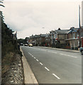
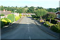
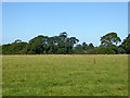
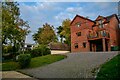
Photos of Seaview and Nettlestone


Area Information
Seaview and Nettlestone is a compact built-up area spanning 1.2 km², situated in England. Its population, while not explicitly stated, is reflected in its median age of 70, suggesting a community skewed toward older residents. This area is characterised by its proximity to transport networks and amenities, making it practical for daily life. Residents benefit from multiple railway stations, ferry ports, and airports within reach, facilitating both local and regional travel. The presence of Nettlestone Primary School, rated ‘good’ by Ofsted, underscores the area’s appeal to families. Daily life here balances quiet residential living with accessible services, from retail outlets like Tesco Ryde to leisure options such as the Isle of Wight Steam Railway. The high home ownership rate of 84% indicates a stable, long-term community, though the demographic profile suggests a distinct character shaped by its older population. For those considering living in Seaview and Nettlestone, the blend of practicality and proximity to key services is a defining feature.
- Area Type
- Built Up Area 250
- Area Size
- 1.2 km²
- Population
- Not available
- Population Density
- Not available
Living in Seaview and Nettlestone offers access to a range of amenities within practical reach. Retail options include Tesco Ryde, Spar, and The Southern Co-operative, catering to daily shopping needs. The area is served by multiple railway stations, including Smallbrook Junction on the Isle of Wight Steam Railway, which adds a unique charm for rail enthusiasts. Ferry services from Ryde Hoverport and Portsmouth Millennium Pontoon provide easy access to the mainland and beyond. Airports like Bembridge Airport are nearby, enhancing travel flexibility. These amenities contribute to a convenient lifestyle, blending practicality with the appeal of coastal and rail connectivity.
Amenities
Schools
The nearest school to Seaview and Nettlestone is Nettlestone Primary School, which serves the local community. Rated ‘good’ by Ofsted, it provides a solid foundation for primary education. The absence of secondary schools or other educational institutions in the data means families may need to look beyond the immediate area for secondary education. However, the presence of a well-rated primary school is a key draw for families considering the area. The school’s performance suggests a commitment to education quality, though parents should verify the availability of transport links to secondary schools if needed.
| Rank | A + A* % | School | Type | Entry gender | Ages |
|---|---|---|---|---|---|
| 1 | N/A | Nettlestone Primary School | primary | N/A | N/A |
Explore more schools in this area
Go to Schools tabDemographics
The population of Seaview and Nettlestone has a median age of 70, with the most common age range encompassing all demographics. Home ownership is high, at 84%, reflecting a community where property is predominantly owner-occupied. The data does not specify household types or accommodation categories, but the overall figures suggest a stable, settled population. The absence of detailed breakdowns on ethnicity or religion means the area’s diversity remains unquantified. However, the high home ownership rate implies a lower turnover of residents, contributing to a cohesive local environment. For those prioritising a low-risk, established neighbourhood, the demographic profile aligns with a community that values permanence. The median age also indicates a population where older residents may form a significant proportion, which could influence local services and amenities.
Household Size
Accommodation Type
Tenure
Ethnic Group
Religion
Household Composition
Age
Household Deprivation
NS-SEC
Explore more demographic insights in this area
Go to Demographics tabPlanning
Planning Constraints
- Crime RiskLocked