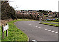
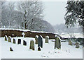
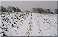
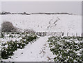
Area Overview for Seaford West Ward
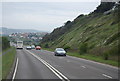
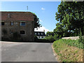
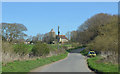
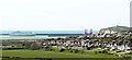
Photos of Seaford West Ward
Area Information
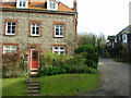
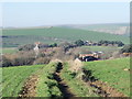
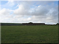
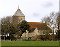
Living in Seaford West Ward means residing in a compact district borough unitary ward that covers 5.1 km² of land in England. This specific area forms a distinct part of the wider Seaford landscape, offering a rounded neighbourhood experience within a significant size. The location attracts residents who value a settled community atmosphere over sprawling urban environments. You will find that daily life here revolves around a localised circle of amenities and thoroughfares rather than extensive commuting distances within the ward itself. The scale of the area supports a sense of familiarity, as the physical boundaries are defined and manageable. Prospective buyers should note that this ward represents a specific administrative unit where local governance aligns with family-sized or retirement-oriented living patterns. The geography allows for easy navigation, whether you are walking to a local shop or driving along the surrounding roads. Residents appreciate the balance between openness and connectedness that the 5.1 km² footprint provides. It is an environment where the proximity of services to your home remains consistent without the congestion found in larger, denser boroughs. This status as a ward unit ensures that local planning and maintenance are managed with attention to the specific needs of its inhabitants.
- Area Type
- District Borough Unitary Ward
- Area Size
- 5.1 km²
- Population
- Not available
- Population Density
- Not available
Demographics
The community in Seaford West Ward is defined by a clear age profile, with a median age of 70 years. This statistic indicates that the majority of the population falls into the older demographic bracket, making it an area predominantly suited for retirees or mature residents. You will encounter a neighbourhood where life pace often reflects the rhythm of later years, moving away from the hustle associated with younger workforce populations. Almost all residents fall into the total age category structure, suggesting a uniform shift away from childhood or young adulthood demographics. Home ownership stands at an impressive 88%, revealing a community where most households own their property outright or have significant equity. This high level of ownership contributes to long-term stability within the streets, as families are less transient than in rental-heavy zones. Household composition data shows that the area is structured around total household units, reinforcing the idea of permanent, settled living arrangements. Accommodation types reflect this stability, with a focus on tenure models that allow residents to remain in their homes securely. There is no significant minority ethnic grouping to report as a predominant factor in the census data for this ward. Religious affiliation figures are similarly totalled, pointing to a secular or mixed-faith community where no single denomination dominates the demographic landscape.
Household Size
Accommodation Type
Tenure
Ethnic Group
Religion
Household Composition
Age
Household Deprivation
NS-SEC
Explore more demographic insights in this area
Go to Demographics tabPlanning
Planning Constraints
- Flood RiskPremium
- Ramsar Wetland SitesPremium
- Area of Outstanding Natural BeautyPremium
- Protected Nature ReservePremium
- Protected WoodlandPremium