Area Overview for Rottingdean & West Saltdean Ward
Photos of Rottingdean & West Saltdean Ward
Area Information
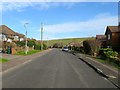
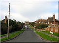
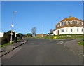
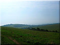
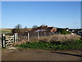
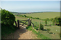
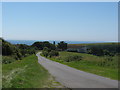
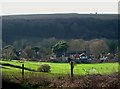
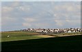
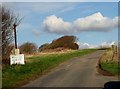
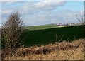
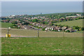
Rottingdean & West Saltdean Ward stands as a distinct 8.5 km² electoral ward within the city of Brighton and Hove in the South East of England. This coastal parish area encompasses the historic village of Rottingdean and extends westwards to Saltdean. You will find it borders the areas of Saltdean, Ovingdean, and Woodingdean. The ward became part of the county borough of Brighton in 1928 before regaining an independent parish council in 1996. Current records show a resident population of 4,993 people. This figure reflects a settled community rather than a transient market. The ward holds a significant place in local history, having been founded by Neolithic people around 2500 BC. Evidence of occupation spans the Bronze Age, Iron Age, Roman, and Saxon periods. Formerly a farming community, the area transitioned into a genteel alternative to Brighton from the late 18th century. Rudyard Kipling and Sir Edward Burne-Jones lived here during the 19th century. Today, the environment blends historic village character with coastal appeal. You can enjoy magnificent views of the countryside and sea. Key local features include Rudyard Kipling's house near the village pond and the Grade II* listed Saltdean Lido. The ward also contains a modernist architectural structure known as St Dunstan's. Living in Rottingdean & West Saltdean Ward offers a direct connection to this layered heritage without the density of the main city centre.
- Area Type
- District Borough Unitary Ward
- Area Size
- 8.5 km²
- Population
- 4993
- Population Density
- 584 people/km²
Demographics
The community in Rottingdean & West Saltdean Ward reflects a settled, established demographic profile. The current median age for residents is 70 years old. This statistic indicates a population skewed significantly towards older age groups. Consequently, you will likely encounter a mature resident base in any homes in Rottingdean & West Saltdean Ward. Home ownership is the defining characteristic of the household structure here. The data confirms that 79% of households own their property. This high level of ownership suggests stability and long-term residency rather than a transient rental population. The ward does not contain specific data regarding predominant ethnic groups or religious affiliations in the provided records. While the presence of schools near Rottingdean & West Saltdean Ward is a common concern for younger families, the current age profile suggests the area caters primarily to older buyers. The lack of detailed breakdowns for academy percentages or deprivation indices in the available figures means the economic picture relies on the strong homeownership metric. You can expect a neighbourhood where residents have invested decades in their properties. This demographic reality shapes the local cultural environment and the types of amenities that have developed to serve the needs of an older population.
Household Size
Accommodation Type
Tenure
Ethnic Group
Religion
Household Composition
Age
Household Deprivation
NS-SEC
Explore more demographic insights in this area
Go to Demographics tabPlanning
Planning Constraints
- Flood RiskPremium
- Ramsar Wetland SitesPremium
- Area of Outstanding Natural BeautyPremium
- Protected Nature ReservePremium
- Protected WoodlandPremium
- Crime RiskPremium