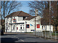
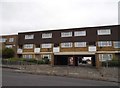
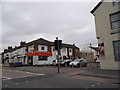
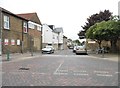
Area Overview for Roman Ward
Photos of Roman Ward


Area Information
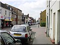
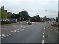
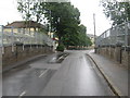
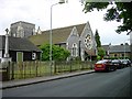
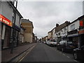
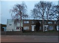
Roman Ward is a compact district within the borough of Tower Hamlets in east London, covering an area of just 1.3 square kilometres. This small footprint often suggests a tightly knit neighbourhood where residents know their surroundings well. The locality sits on the corner of Whitechapel and Spitalfields, places defined by their historic diamond shaped zones and rich architectural heritage. You will find that daily life here moves at a deliberate pace compared to the surrounding high streets. The ward contains a mix of residential properties set against a backdrop of significant industrial and commercial landmarks. Houses in Roman Ward benefit from excellent digital infrastructure, providing a strong foundation for modern independent living. Despite its size, the area possesses a distinct character shaped by its Victorian roots and proximity to the city centre. Living in Roman Ward means enjoying a location that balances historical charm with contemporary urban conveniences. The compact nature of the district allows for easy navigation, whether you are walking to local shops or transitioning to other parts of the city. This area offers a stable environment for those seeking a home with clear boundaries and a defined sense of place.
- Area Type
- District Borough Unitary Ward
- Area Size
- 1.3 km²
- Population
- Not available
- Population Density
- Not available
Demographics
The community in Roman Ward is notably older than the national average, with a median age of seventy years. You will find that the most common age group represents the total population, indicating a diverse spread across generations. This demographic profile suggests a locality where retirement and established households form a significant portion of the residents. Home ownership stands at 59 per cent, meaning that slightly more than half of the households in Roman Ward own their property outright. This figure points to an area where long-term settlement is common and residents have a strong equity stake in their homes. Accommodation types and household compositions vary, creating a residential landscape that supports different family structures. While specific ethnic and religious breakdowns are not detailed in the current records, the area reflects the broader diversity of London. The older population often implies a quieter atmosphere, though the high rate of owner occupancy ensures that investment and stability remain key themes. Families considering schools near Roman Ward should be aware that the age profile leans heavily towards mature residents. This demographic reality shapes the social fabric of the ward and influences local services and amenities available to newcomers.
Household Size
Accommodation Type
Tenure
Ethnic Group
Religion
Household Composition
Age
Household Deprivation
NS-SEC
Explore more demographic insights in this area
Go to Demographics tabPlanning
Planning Constraints
- Flood RiskPremium
- Ramsar Wetland SitesPremium
- Area of Outstanding Natural BeautyPremium
- Protected Nature ReservePremium
- Protected WoodlandPremium
- Crime RiskPremium