Area Overview for Rogate
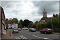
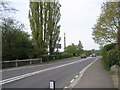
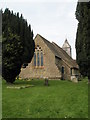
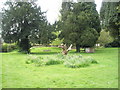
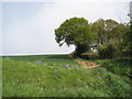
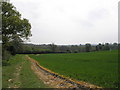
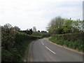
Photos of Rogate

Area Information
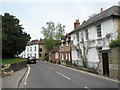
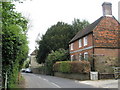
Rogate is a small built-up area in England, covering 22.2 hectares. It is a place where daily life unfolds with a quiet rhythm, shaped by its older population and proximity to essential services. The area’s compact size means amenities are within practical reach, and its rail links to Liss, Petersfield, and Liphook offer convenient access to nearby towns. Rogate’s character is defined by its demographic profile: with a median age of 70, it is a community where many residents are retired or long-established. The area’s 70% home ownership rate suggests a stable, settled population, and the presence of Rogate CofE Primary School, rated ‘good’ by Ofsted, indicates a focus on family needs. While not a bustling urban centre, Rogate offers a blend of practicality and tranquillity, appealing to those prioritising safety, accessibility, and a slower pace of life. For buyers seeking a low-maintenance, community-oriented environment, Rogate provides a foundation of simplicity and reliability.
- Area Type
- Built Up Area 250
- Area Size
- 22.2 hectares
- Population
- Not available
- Population Density
- Not available
Rogate’s lifestyle is shaped by its proximity to retail and rail amenities. Within practical reach are five retail outlets, including Tesco Liss, The Southern Co-operative Co, and Asda Ramshill, providing everyday shopping convenience. These stores cater to basic needs, though the absence of specialist shops or dining options suggests a focus on utility over variety. The three nearby railway stations—Liss, Petersfield, and Liphook—enhance mobility, allowing residents to access broader services, employment, or social opportunities in larger towns. While the data does not mention parks or leisure facilities, the area’s compact nature means residents can likely reach green spaces or recreational areas within a short journey. The combination of retail access and rail connectivity supports a practical, low-effort lifestyle, ideal for those prioritising ease of access over extensive leisure options.
Amenities
Schools
Rogate CofE Primary School is the only school explicitly listed in the data, serving the area’s primary education needs. As a primary school with an Ofsted rating of ‘good’, it offers a solid foundation for young learners, though the absence of secondary schools or other educational institutions in the immediate vicinity may require families to consider nearby towns for secondary education. The presence of a single school suggests that Rogate’s demographic profile, with its older population, may have fewer children in the area compared to other regions. For families with young children, this school is a key consideration, but those requiring broader educational options may need to look beyond Rogate’s boundaries. The school’s rating indicates a satisfactory standard of teaching and facilities, though its isolation from other schools could be a practical challenge for some households.
| Rank | A + A* % | School | Type | Entry gender | Ages |
|---|---|---|---|---|---|
| 1 | N/A | Rogate CofE Primary School | primary | N/A | N/A |
Explore more schools in this area
Go to Schools tabDemographics
Rogate’s population is predominantly older, with a median age of 70, reflecting a community where retirement is a common stage of life. The area’s home ownership rate stands at 70%, suggesting a majority of residents live in properties they own rather than rent. This statistic aligns with the area’s character as a place where long-term residency is more common than transient living. While the data does not specify household composition or ethnic diversity, the high median age implies a population shaped by decades of settlement. For those considering Rogate, this demographic profile means a neighbourhood with a strong sense of continuity, though it may lack the dynamism of areas with younger, more diverse populations. The absence of detailed data on accommodation types or household structures means further insights into the community’s makeup remain unexplored.
Household Size
Accommodation Type
Tenure
Ethnic Group
Religion
Household Composition
Age
Household Deprivation
NS-SEC
Explore more demographic insights in this area
Go to Demographics tabPlanning
Planning Constraints
- Crime RiskLocked