Area Overview for RH9 8BP
Photos of RH9 8BP


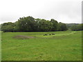
50 photos from this area
Area Information
Key information about the RH9 8BP including its size, population, and administrative classification.
- Area Type
- Postcode
- Area Size
- 9.3 hectares
- Population
- 1360
- Population Density
- 235 people/km²
House Prices in RH9 8BP
11
Properties
£357,714
Average Sold Price
£90,500
Lowest Price
£600,000
Highest Price
Showing 11 properties
| Address | Type | Beds | Baths | Last Sale Price | Last Sale Date | |
|---|---|---|---|---|---|---|
| 1, Sunnyside, Oxted Road, Godstone, RH9 8BP | Semi-detached | 3 | 2 | £575,000 | Jul 2022 | |
| 2, Hillview, Oxted Road, Godstone, RH9 8BP | Terraced | 3 | - | £507,500 | Dec 2020 | |
| 1, Hillview, Oxted Road, Godstone, RH9 8BP | Terraced | 5 | - | £600,000 | Nov 2016 | |
| 3, Sunnyside, Oxted Road, Godstone, RH9 8BP | house | - | - | £299,000 | Apr 2007 | |
| 4, Sunnyside, Oxted Road, Godstone, RH9 8BP | Terraced | 3 | 1 | £200,000 | Sep 2005 | |
| 2, Sunnyside, Oxted Road, Godstone, RH9 8BP | Terraced | 3 | 1 | £232,000 | Jan 2003 | |
| 3, Hillview, Oxted Road, Godstone, RH9 8BP | Terraced | - | - | £90,500 | Sep 1996 | |
| Sutton & East Surrey Water Plc, Godstone Water Treatment Works, Oxted Road, Godstone, RH9 8BP | Industrial | - | - | - | - | |
| 1, Clifton Cottages, Oxted Road, Godstone, RH9 8BP | house | - | - | - | - | |
| 2, Clifton Cottages, Oxted Road, Godstone, RH9 8BP | Flat | - | - | - | - |
Page 1 of 2
Energy Efficiency in RH9 8BP
Amenities
Schools
| Rank | School | Type | Entry gender | Ages |
|---|
Explore more schools in this area
Go to Schools tabDemographics
Household Size
Two person
most common
Accommodation Type
Houses
most common
Tenure
78
majority
Ethnic Group
White
most common
Religion
N/A
most common
Household Composition
N/A
most common
Age
47
median
Adults (30-64 years)
most common
Household Deprivation
N/A
with no deprivation
NS-SEC
46
in Lower managerial occupations
Explore more demographic insights in this area
Go to Demographics tabPlanning
Planning Constraints
- Flood RiskPremium
- Ramsar Wetland SitesPremium
- Area of Outstanding Natural BeautyPremium
- Protected Nature ReservePremium
- Protected WoodlandPremium